Ahead of the arrival of the system, it will be colder, bright, blustery, and brisk on Thursday, March 21 with plenty of sunshine and a high temperature in the low 40s.
Gusts will be as strong as 25 miles per hour, leading to wind-chill values in the upper teens.
It will remain clear on Friday, March 22 with a high temperature in the low 40s.
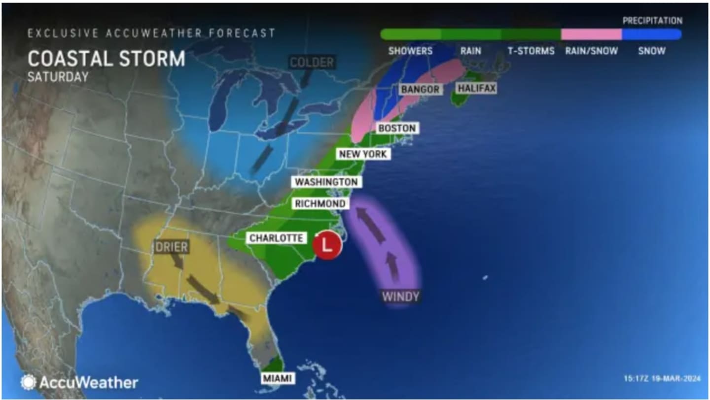
A new cold front will move through overnight, bringing widespread rain showers from the middle of the evening into the afternoon on Saturday, March 23 with a mix of rain likely farther inland. (See the image above from AccuWeather.com.)
The window for snow and sleet in inland areas is from about 2 a.m. to 8 a.m. Saturday. Little or no accumulation is expected.
Farther south during that time, snow will mix with rain, and near the coast, mainly rain is expected.
Rain is likely at times during the day and into Saturday evening as the high temperature climbs to the upper 40s to around 50 degrees.
Overnight Saturday into Sunday, rain could again mix with light snow before the system winds down shortly after daybreak on Sunday, March 24.
Skies will gradually become partly sunny Sunday. It will be breezy with a high temperature in the mid-40s.
Check back to Daily Voice for updates.
Click here to follow Daily Voice Orangetown and receive free news updates.