Find Your Daily Voice
 45°
45°
Tag: Southern Connecticut
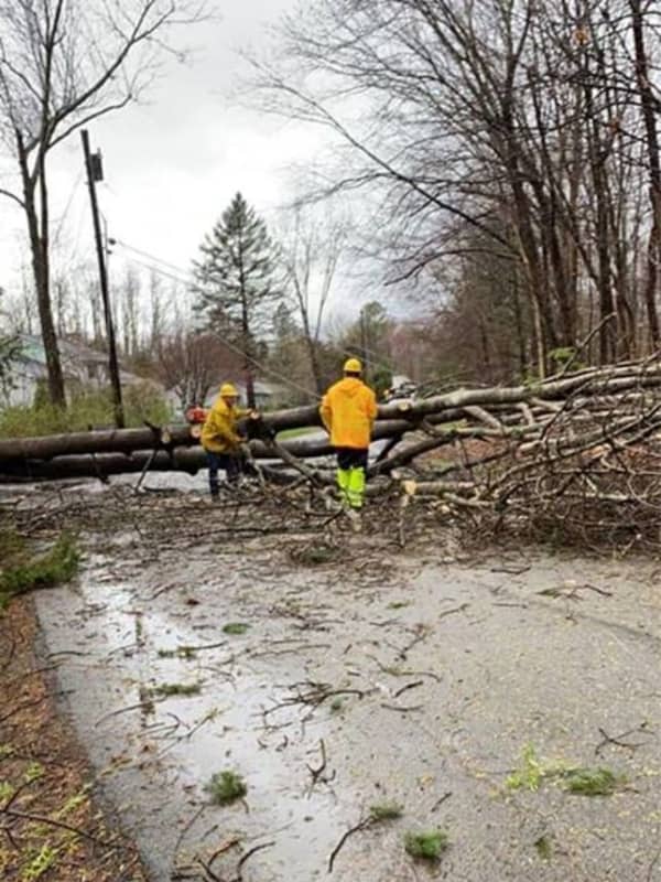
Storm Knocks Out Power To More Than 100,000 In Hudson Valley
A powerful storm system bringing heavy downpours and damaging winds has resulted in numerous downed tree limbs, leading to road closures and more than 100,000 power outages in the Hudson Valley.
Here are the number of customers without power just before 8:15 a.m. on Christmas Day, Friday, Dec. 25 by utility company (click on each link for breakdowns by community):
Con Edison - 17,598
NYSEG - 24,469
Central Hudson - 33,163
Orange & Rockland County - 26,107
In areas hardest hit, residents are being urged to avoid travel Christmas morning to allow utility crews to clear roadways …
by
Daily Voice
Hazardous Weather Outlook Issued By National Weather Service For Powerful Christmas Eve Storm
The National Weather Service has issued a Hazardous Weather Outlook statement for a powerful system that will sweep through the area on Christmas Eve, bringing drenching rain, thunderstorms, and damaging winds that could cause power outages.
The time frame for the storm is Thursday night, Dec. 24 into Friday morning, Dec. 25.
"The combination of lingering snowpack and heavy rain may bring flooding, with the highest potential across northeast New Jersey, the Lower Hudson Valley, and southern Connecticut," said the National Weather Service statement, issued early Tuesday mornin…