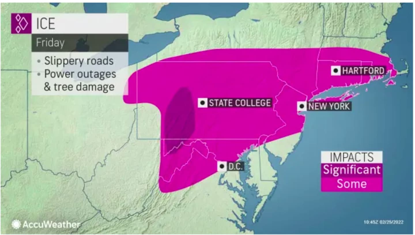


The wide area where icy conditions are causing slippery travel conditions are shown in the first image above.
A look at the types of precipitation by area on Friday, Feb. 25 are shown in the second image above: Rain/snow/ice (in pink), snow (blue), and rain/showers (green).
Click on the second image above for a look at the types of precipitation the storm will bring, with rain in green, rain/snow/ice in purple, and snow in blue.
As for the latests snowfall accumulation predictions, areas in light blue in the third image above are expected to see 1 to 3 inches, areas in Columbia blue 3 to 6 inches, areas in blue 6 to 12 inches, and areas in Royal blue 12 to 18 inches, according to AccuWeather.com.
Winter weather advisories are in effect in the region through the early afternoon Friday.
"Around New York City, warm air to the south will win the war on Friday with rain for much of the area, after sleet and freezing rain fell on Thursday night," said AccuWeather Senior Meteorologist Alex Sosnowski.
"A gradual transition to rain will then take place into Friday morning. However, roads and sidewalks are likely to still be slippery especially over the northern and western suburbs and in parts of central Long Island, where the wintry mix is likely to linger for a time."
The storm will start winding down from west to east starting late Friday morning, followed by a mix of rain and snow, the National Weather Service says. There could be dangerous icy conditions during the morning commute and sleet could be heavy at times during the morning on Friday before the changeover to rain.
Skies will clear Friday night, leading to a mostly sunny day on Saturday, Feb. 26.
Icy conditions will continue Saturday as the temperature will remain at around the freezing mark with a high temperature in the low 30s and wind-chill values in the teens.
Sunday, Feb. 27 will be sunny and blustery with a high around 40 degrees, and wind speeds between 10 and 15 miles per hour with gusts as high as 25 miles per hour, and higher farther south, according to the National Weather Service says.
Check back to Daily Voice for updates.
Click here to follow Daily Voice Nassau and receive free news updates.