The projected timing for the storm is from late Sunday night, Jan. 28 into early Monday afternoon, Jan. 29, according to the National Weather Service.
"The storm is expected to help force enough cold air southward from Canada to produce a swath of heavy, wet snow," said AccuWeather Meteorologist Brandon Buckingham.
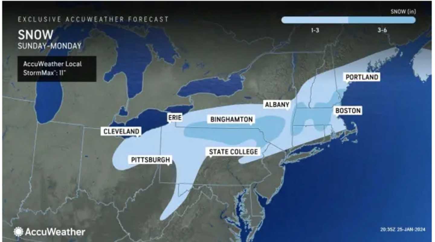
Areas in the darker shade of blue in the image above from AccuWeather.com are expected to see 3 to 6 inches of accumulation with 1 to 3 inches forecast in the areas in lighter blue.
Areas farthest south, including New York City, Long Island, and much of coastal New England are expected to see a mix of snow, sleet, and rain.
Ahead of the arrival of the storm, there will be a new round of rain Thursday night, Jan. 25 into Friday morning, Jan. 26. Also look for patchy fog after daybreak.
Ahead of the arrival of the storm, morning showers on Friday morning, Jan. 26 will be followed by dry conditions much of the day with cloudy skies lingering and a high temperature in the mid-40s.
It will dry out on Saturday, Jan. 27 but clouds will linger with peeks of sun and a high temperature in the mid-40s before the latest round of unsettled weather arrives overnight into Sunday.
Sunday will be raw with cooler temperatures and rain likely at times during the day and again at night when the storm will move in.
The high temperature Sunday will range from the upper 30s to around 40 degrees, before dipping below freezing overnight.
Monday's high temperature will hold steady at around the freezing mark with mostly cloudy skies throughout the day.
There is still some uncertainty surrounding the timing, track, and strength of the system.
Check back to Daily Voice for updates.
Click here to follow Daily Voice Nassau and receive free news updates.