
As of around 7 p.m. Wednesday, April 3, there were over 60,000 customers without power in New York, around 4,000 in Connecticut, and over a thousand in Massachusetts, according to poweroutage.us.
Check the links below to view outages by counties and utility providers in those states:
A High Wind Warning is in effect for New York, Connecticut, and Massachusetts coastal areas where gusts of up to 60 miles per hour are possible, with widespread power outages expected, according to the National Weather Service, which notes "travel will be difficult."
Inland areas will see widespread gusts of between 40 and 50 mph, with scattered outages.
Winds will be out of the east with speeds of 20 to 30 mph with the higher gusts.
"Gusty winds will blow around unsecured objects," the National Weather Service said in a Hazardous Weather Outlook statement issued at 4 p.m. Wednesday, noting that tree limbs could be blown down as well.
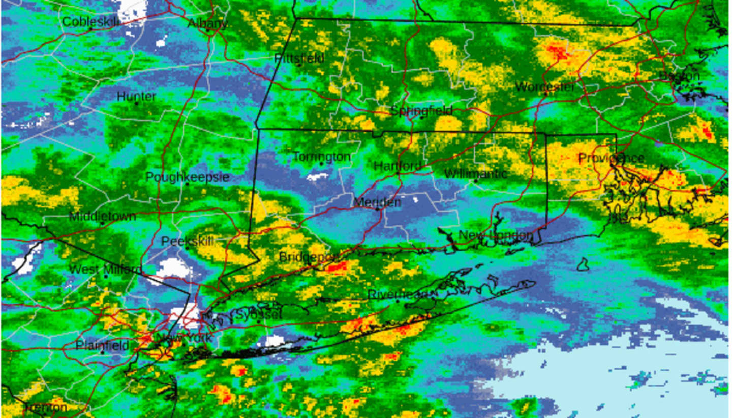
For a radar image of the region at around 5:30 p.m. Wednesday, see the first image above.
A Coastal Flood Warning is in effect into late Thursday morning, with flooding also expected to extend inland.
"Numerous road closures are likely, and vehicles parked in vulnerable areas near the waterfront will likely become flooded," according to the National Weather Service.
Thunderstorms are possible starting around nightfall on Wednesday.
Snow is expected Wednesday night into Thursday in a wide part of the Northeast displayed in blue in the second image above from AccuWeather.com with significant snowfall possible in areas shown in dark blue.
Areas in upstate New York and northern New England, the darkest shade of blue could see between 12 and 24 inches of snowfall, with snowfall rates of 2 inches per hour expected at times, possibly making it one of the strongest storms of 2023-24 -- albeit not even in the winter.
About 6 to 12 inches of accumulation is possible in much of New England, including Western Massachusetts, and upstate New York, with a widespread 1 to 6 inches in other areas shown in the two lightest shades of blue.
Areas farther south -- generally south of the I-84 corridor -- will see a mix of rain, sleet, and snow, with little or no accumulation, with mainly rain along the coast.
Precipitation is now expected to wind down as rain for most of the Northeast from west to east beginning shortly after daybreak Thursday morning.
It will be mostly cloudy throughout Thursday with scattered showers during the day and the high temperature in the mid-40s.
Friday, April 5 will be partly sunny with a high in the upper 40s and a slight chance of showers.
The outlook for Saturday, April 6 calls for mostly cloudy skies with temperatures in the mid to upper 40s.
Check back to Daily Voice for updates.
Click here to follow Daily Voice Nassau and receive free news updates.