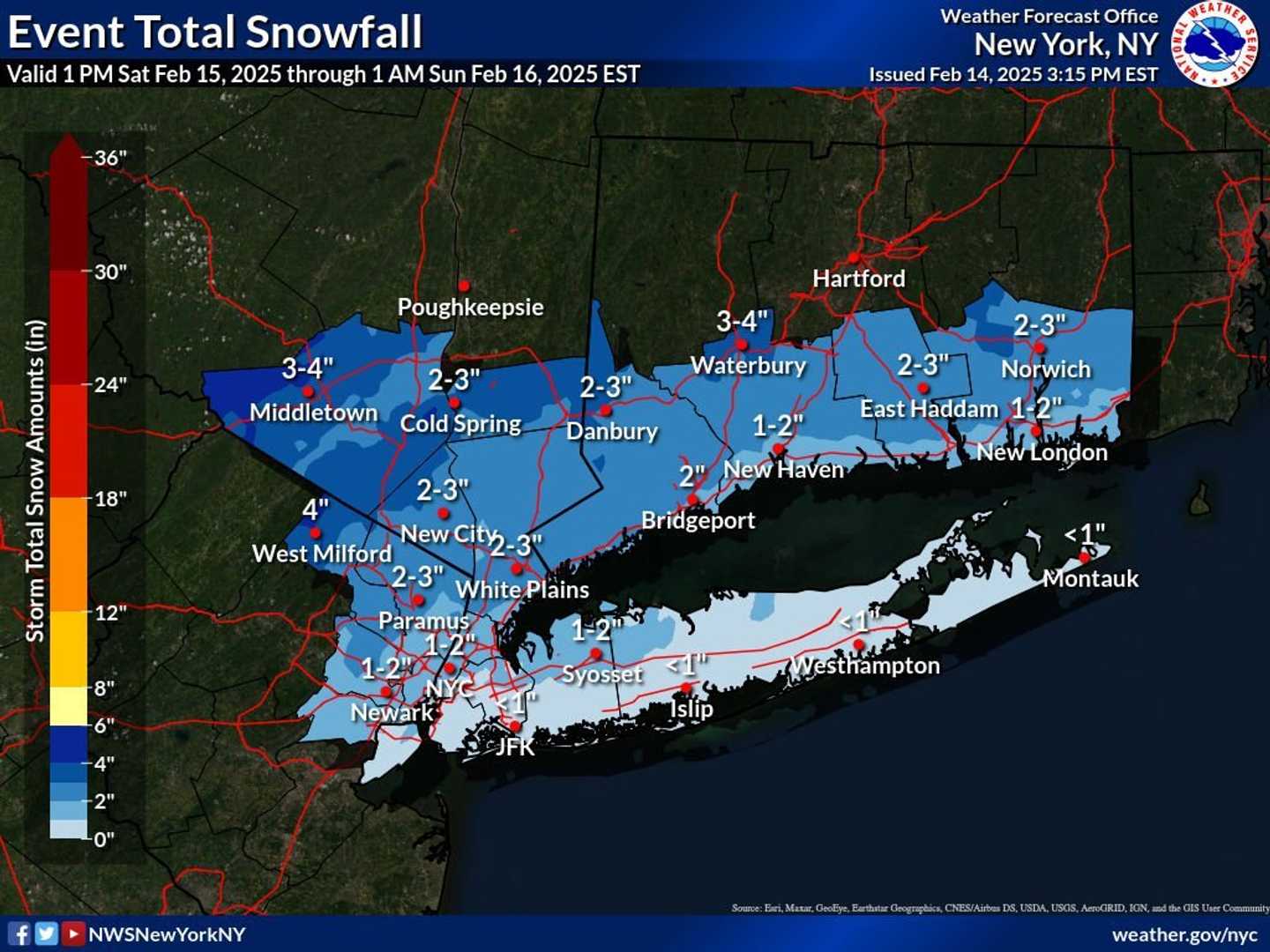
A widespread 2 to 3 inches is predicted for the system, which is due to arrive around midday Saturday, Feb. 15 and continue in the afternoon and evening, before precipitation transitions to rain Saturday evening into Sunday morning, Feb. 16.
A Winter Weather Advisory is in effect for the lower Hudson Valley, northeastern New Jersey, and southern Connecticut from Saturday afternoon until early Sunday morning.
In the first image above, the highest snowfall totals are predicted for the locations shown in the darkest shade of blue, where 4 inches or more of snowfall is expected.
On Long Island, 1 to 2 inches is predicted for most of northern Nassau County, with lower amounts across New York City and Suffolk County.
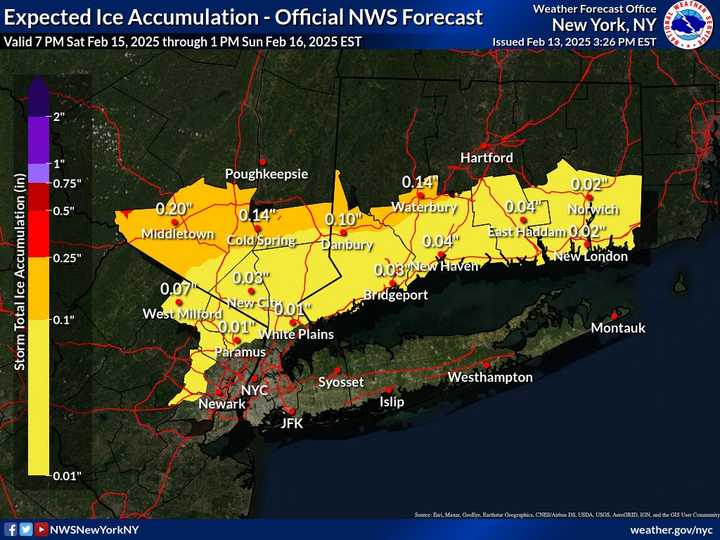
Ice buildup of a up to a couple-tenths of an inch is expected in areas along the I-84 corridor.
Areas where the most ice buildup is expected can be seen by clicking on the second image above.
The outlook for Presidents Day on Monday, Feb. 17, calls for cold temperatures and plenty of sunshine.
Check back to Daily Voice for updates.
Click here to follow Daily Voice Mount Pleasant and receive free news updates.