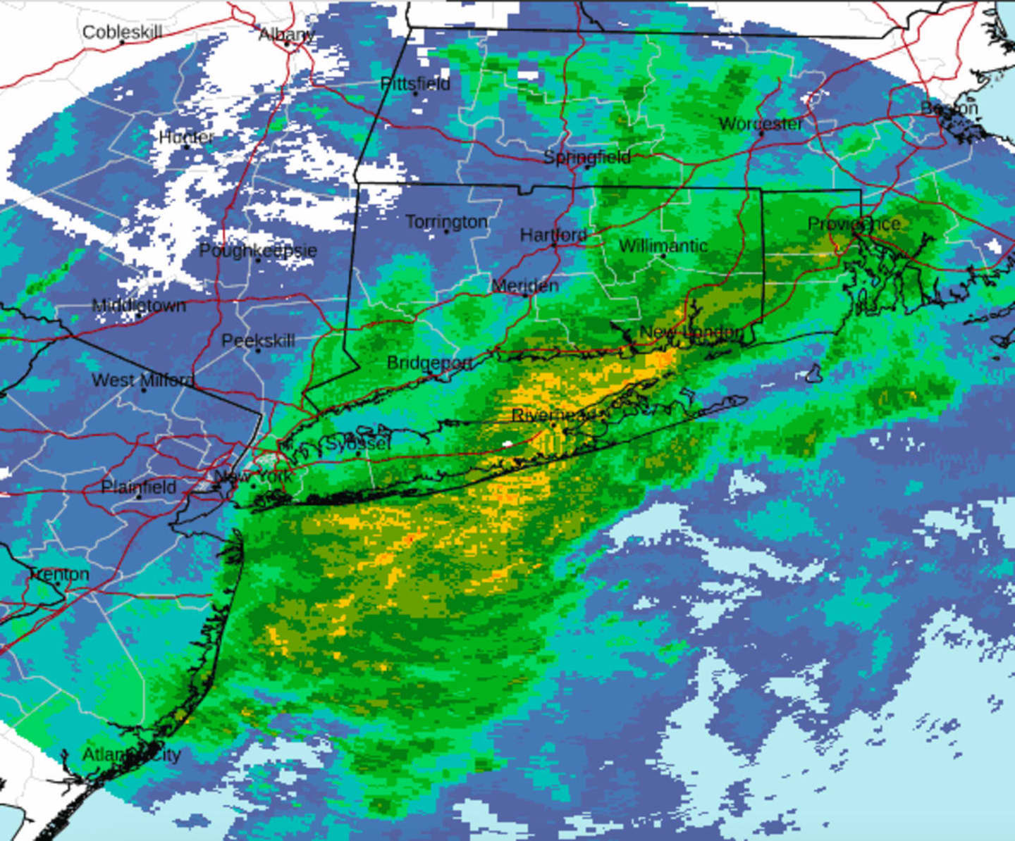
Close to an inch of rain is possible before the system moves out Friday afternoon, Feb. 17 ahead of a cold front that will knock temperatures back down to normal, the National Weather Service says.
As skies gradually become start to clear later Friday afternoon, the temperature will fall into the low 40s, accompanied by strong gusty winds of up to 35 miles per hour.
It will be clear, cold, and blustery overnight with lows in the 20s ahead of a clear and colder day on Saturday, Feb. 18, with a high temperature around the 40-degree mark.
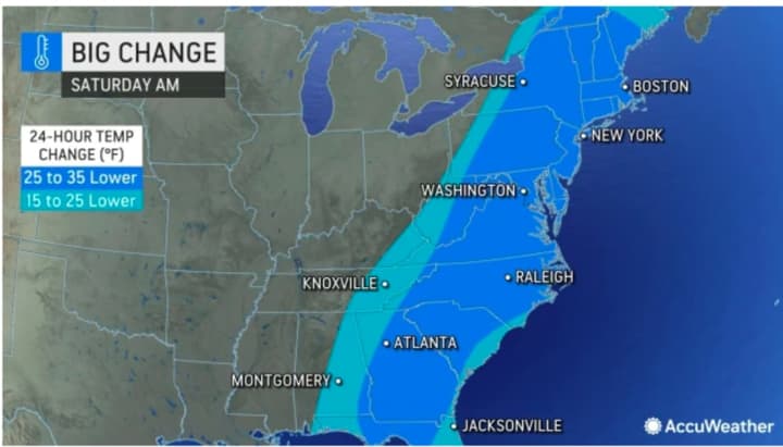
Temperatures Saturday morning will be 25 to 35 degrees colder than they were 24 hours earlier. (See the second image above from AccuWeather.com.)
"It will go from feeling like late April to like mid-February in about 24 hours," according to AccuWeather Chief On-Air Meteorologist Bernie Rayno.
A return to warmer-than-normal temperatures follows for Sunday, Feb. 19, Presidents Day on Monday, Feb. 20 through Tuesday, Feb. 21.
Check back to Daily Voice for updates.
Click here to follow Daily Voice Armonk and receive free news updates.