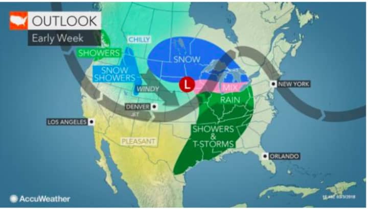
A new winter storm brewing in the Upper Midwest could develop into another Nor'easter bringing up to a half-foot or more of snow to the area in the middle of the workweek.
The storm will move across the country, producing blizzard conditions in the northern Plains early in this week before bringing snow in the Midwest and then possibly becoming a coastal storm in the Northeast on Wednesday that could result in 3 to 6 inches or more of snow for much of the tristate area, according to the National Weather Service.
Whether higher snow amounts will be along the coast or farther inland is uncertain as the storm is still several days away.
The new storm will come just five days after a fierce Nor'easter slammed the region on Friday, resulting in numerous downed trees, road closures and hundreds of thousands of power outages.
After partly to mostly sunny days with high temperatures in the low- to mid-40s Sunday through Tuesday, the snow is expected to arrive in the predawn hours Wednesday and continue through the evening. Winds accompanying the new storm are not expected to be as severe as last week's Nor'easter at this time.
Temperatures will be in the low-40s Thursday with partly sunny skies.
There is still much uncertainty about the track of the storm and projected snow amounts could change.
Check back to Daily Voice for updates.
You can share this story on Facebook by clicking on the Facebook icon below.
Click here to follow Daily Voice Armonk and receive free news updates.


