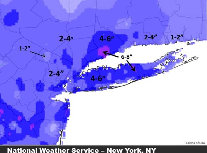
Though some earlier projections forecast higher accumulations farther east, areas to the west wound up having more snowfall, with the 6 to 8 inches in south-central Fairfield County, Conn., being the highest.
Peekskill, on the Westchester/Putnam border, reported 2.4 inches of accumulation, but farther south, in White Plains, 4 inches was reported.
The Winter Storm Advisory, originally scheduled to expire at 2 a.m. Saturday, was extended to 4 a.m. Saturday.
The outlook for Saturday calls for mostly cloudy skies with a high between 43 and 45 degrees, with the wind-chill factor between 25 and 35 degrees.
The March 2015 equinox, which signals the official start of spring, occurred at 6:45 p.m. Friday.
Click here to follow Daily Voice Armonk and receive free news updates.
