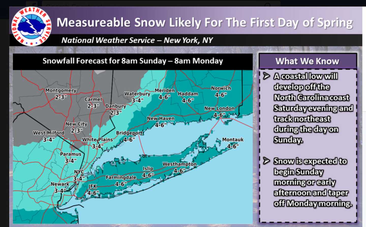
A potential start-of-spring snowstorm could bring several inches of accumulation to parts of the area Sunday into Monday morning.
Snow accumulation is possible in some spots, though new weather models Friday afternoon show the path of the storm being farther east, meaning lower potential snow totals. The snow could mix with rain, especially along the coast, for periods of time.
The storm, which is moving to the Northeast from the South, is likely to bring accumulating snow from the I-95 corridor to part of the Appalachians, with the heaviest snow across New England, according to AccuWeather.com.
Snowfall amounts could vary from 1 inch to up to 4 inches inches in the Hudson Valley. Projected totals for the Hudson Valley are now mainly either 2-3 inches or 3-4 inches of accumulation. (See accompanying image.) Some projections made Thursday called for a possible 6-12 inches of accumulation.
Snow is expected to start Sunday morning or early Sunday afternoon and taper off Monday morning.
The exact track of the storm is still not clear, and accumulation projections could change.
Check back to Daily Voice for updates on the storm potential.
Click here to follow Daily Voice Armonk and receive free news updates.