
An arctic blast now making its way into our region will drop temperatures to record lows, especially on Saturday into Sunday, when Cupid will definitely need to swap his diaper for some long johns, says AccuWeather.com.
The front will stretch from Philadelphia to Boston and beyond, forecasters say, and bring biting winds, flurries, and even some sudden bursts of snow.
These will cause dangerous conditions for anyone outside, especially the homeless, they said.
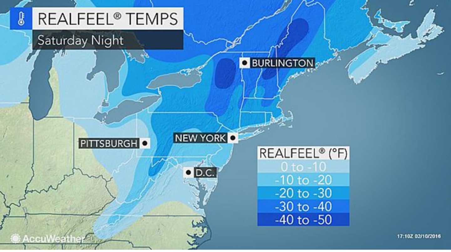
Temperatures on Friday night into Saturday will hover around 20, AccuWeather.com said, but the winds will make it feel like more below zero.
A Wind Chill Watch begins at 6 p.m. Saturday run through noon Sunday. The will be the coldest part of the weekend as temperatures plunge below zero, with what the National Weather Service describes as "life threatening wind chills" of -25 to -30 due to strong northwest winds in the evening and overnight into the morning.
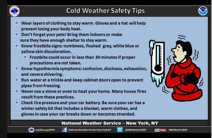
The hazards include extreme and dangerous cold; frozen pipes, frostbite and hypothermia.
The National Weather Service advises residents to wear layers, including hats and gloves; bring pets indoors; and to heat homes safely and only with indoor approved devices.
On Valentine’s Day, temperatures may challenge a record low of 2 that was set in 1916, AccuWeather.com said.
Early next week, the mercury may rise, but snow, ice and rain may strike the region on Monday night into Tuesday, according to the National Weather Service
The day-to-day predictions are, according to the National Weather Service:
- Friday: Mostly sunny, with a slight chance of snow. Highs, 25.
- Saturday: Cold and windy. Highs, 16.
- Sunday: Sunny and blustery. Highs, 16.
- Monday: Partly sunny, chance of snow. Highs, 30.
To read AccuWeather.com’s report on the polar vortex, click here.
Click here to follow Daily Voice Armonk and receive free news updates.