- How Much Snow Did You Get? A Look At Totals From The Area
- Storm Photos Submitted By Daily Voice Readers
After back-to-back Nor'easters hammered the area the last week, more wintry weather is on the way, including the chance of yet another major storm early next week.
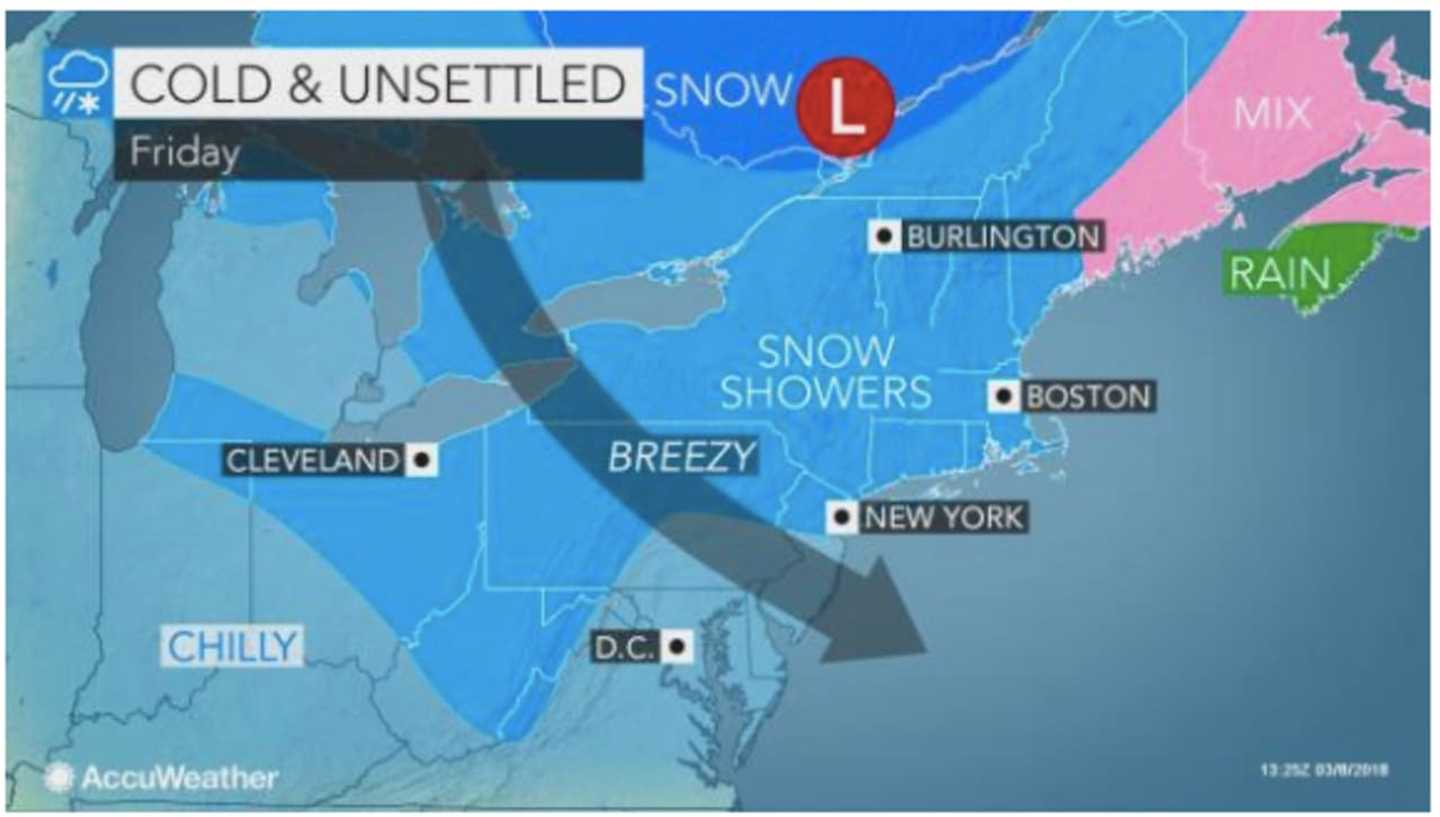
Scattered snow showers are expected at times Friday morning and Friday afternoon.
Friday's high temperature will reach 40 degrees, allowing for some melting of snow, but the wind-chill factor will be between 20 and 30 degrees.
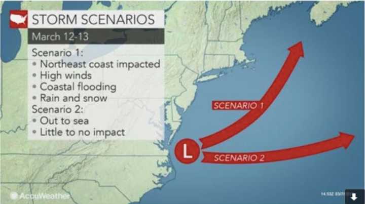
After mostly sunny days Saturday and Sunday with highs in the low-40s, there is a chance for another Nor'easter on Monday.
Right now, there are two scenarios for the storm, with the second scenario seeing the storm move out to sea, which would mean no heavy precipitation. (See second image above.)
In the first scenario, a northward track might mean another Nor'easter with strong winds and heavy rain and/or snow, according to AccuWeather.com.
"There is a window of opportunity for one or two disturbances aloft to help strengthen the storm quickly enough to make a northward turn near the coast," according to AccuWeather Senior Meteorologist Bob Smerbeck. "If either of these two disturbances fail to interact fast enough, the storm will swing too far out to sea for a Nor'easter early next week."
The most likely scenario at this point is a close call but no major storm for the area, says AccuWeather.com.
But there is much uncertainty surrounding the storm's track.
Check back to Daily Voice for updates.
Click here to follow Daily Voice Armonk and receive free news updates.