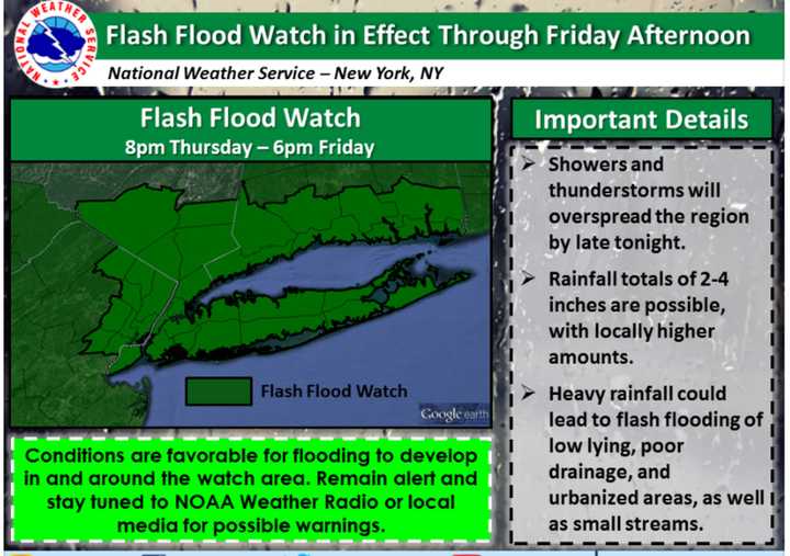
"Showers and thunderstorms will be moving into the region from the west early this evening and will overspread the region by late tonight," the NWS notes. "Showers and thunderstorms will continue into Friday morning and begin to taper off from west to east during Friday afternoon."
The warning includes the potential for periods of heavy rainfall.
"Currently, the heaviest rain is forecast to extend from northeastern New Jersey into the lower Hudson Valley, New York City and southern Connecticut," the NWS says. There may be rainfall totals of 2-4 inches, with more in certain areas.
With flash flooding, the highest threats are to low-lying areas, those with poor drainage and urbanized areas, and smaller streams may also flood.
A flash flood watch is the step before a flash flood warning, and means that conditions may develop that lead to flash flooding. The NWS advises residents to monitor later forecasts and be prepared to take action if flash flood warnings are issued.
The NWS and National Oceanic and Atmospheric Administration have stated that "more deaths occur due to flooding than from any other thunderstorm-related hazard" and "over half of all flood-related drownings occur when a vehicle is driven into hazardous flood water." It only takes 6 inches of fast-moving water to knock an adult down, and a mere 12 inches of water can sweep a small car away.
The agencies have created this video for their "Turn Around Don't Drown" campaign.
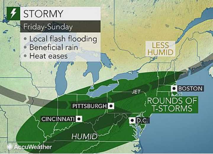
The storm chance lasts through the weekend as there's a chance of heavy rainfall through Sunday.
Check back to Daily Voice for updates.
Click here to follow Daily Voice Armonk and receive free news updates.

