

A quick-moving, major winter storm that will bring as much as a foot of snowfall accumulation, is resulting in blizzard-like conditions, hazardous travel and poor visibility in the Hudson Valley on Thursday morning.
The storm, which will impact the area for about 12 hours Thursday, prompted most schools and school districts to announce closures on Wednesday evening. For the complete rundown of closures, click here.
Visibility may drop to 1/4 of a mile at times. In addition, there will be blowing and drifting snow during a day in which the high temperature struggles to reach 30 degrees with a wind-chill factor making it feel like it's in the teens.
Snowfall rates of 2 to 4 inches per hour are possible through noon Thursday, according to the National Weather Service.
Snow became heavy after dawn and will continue past midday. Winds will gust between 35 and 45 miles per hour, resulting in near-blizzard conditions at times. Scattered power outages are possible.
The snow is expected to taper off in the mid-afternoon Thursday and wrap up by nightfall with temperatures dropping to the mid-teens.
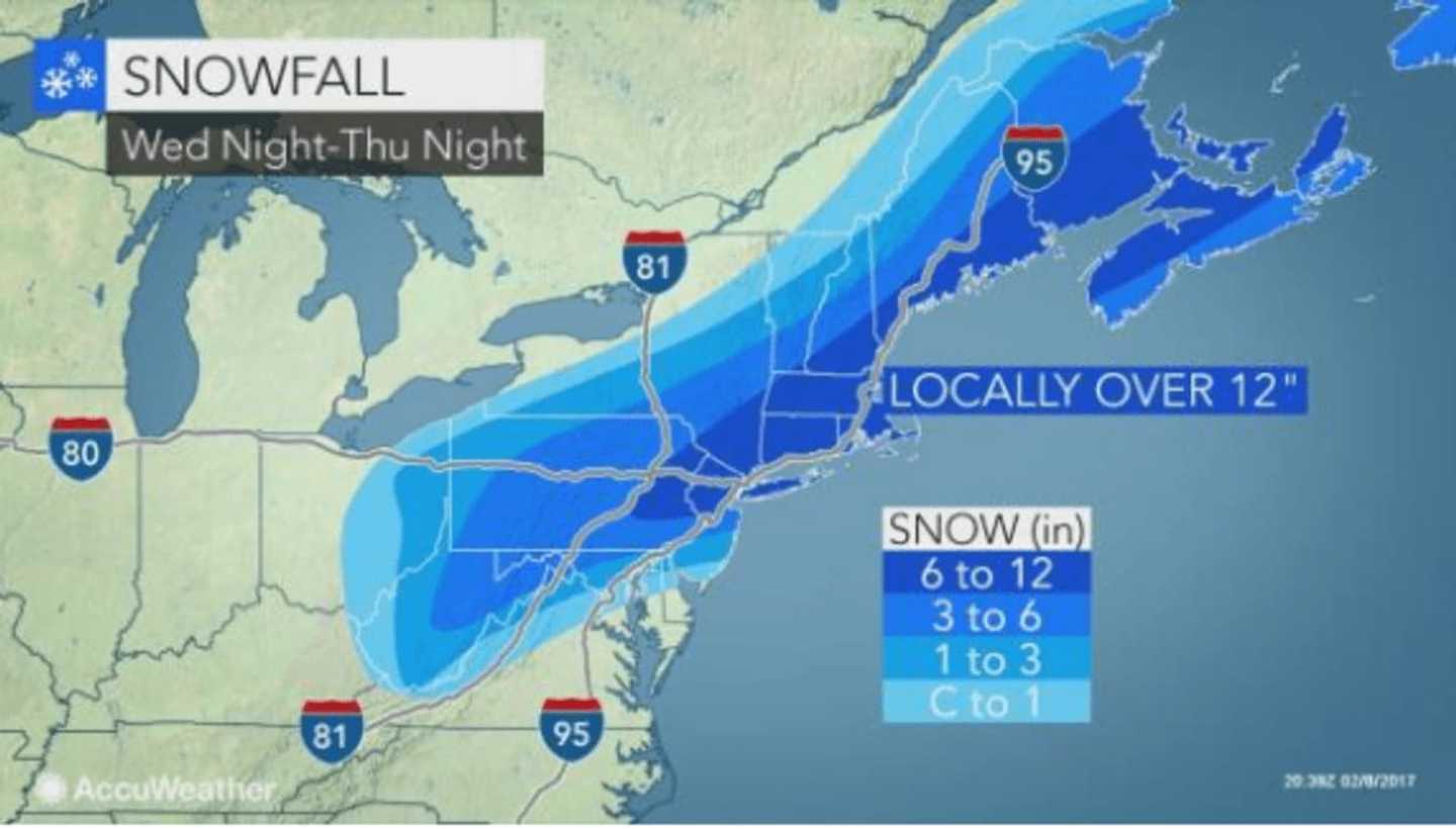
Much of the Hudson Valley will see between 8 and 12 inches of total accumulation, with locally heavier amounts possible, the National Weather Service said.
Sunshine returns to the area Friday, but the cold air continues as the high will only be in the upper 20s. Expect icy conditions and possible black ice in the aftermath of the storm Friday morning that could result in delayed openings at schools.
Areas farther north, including Putnam and Dutchess, could see some light snow before 8 a.m. Saturday on a cloudy day with warmer temperatures reaching a high near 40, there's a chance of a mix of snow and rain is Sunday.
State Police are reminding motorist to use extreme caution and to avoid all unnecessary travel.
Click here to follow Daily Voice Armonk and receive free news updates.