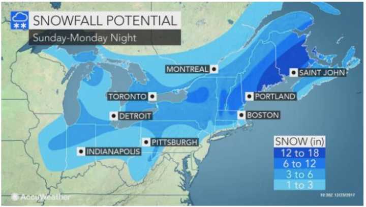
If you go with a snow shovel, chances are, your present will be well-received as merging storms from the Midwest and the Atlantic Coast will combine for what AccuWeather.com calls a "potent Christmas Day Nor'easter" that will result in slippery travel and widespread snow.
How much snow?
The tristate area could see up to 3 inches of accumulation late Sunday night into Monday morning as the region now seems assured of its first White Christmas since 2009, when about 2 inches fell.
If you're traveling farther north, expect up to a half foot, including in Albany, according to AccuWeather.com.
After a rainy day Saturday, Sunday will bring a mix of sun and clouds and a high in the low-40s.
Then comes the storm.
There will be a mix of rain and snow before midnight Christmas Eve, then snow between midnight and 4 a.m., then snow and sleet after 4 a.m.
On Christmas Day, there is a chance of snow and sleet before 8 a.m., then a slight chance of rain and snow until around 11 a.m.
Morning clouds will give way to mostly sunny skies. Monday's high will be in the upper 30s.
Tuesday will be partly sunny with a high around the freezing mark.
Check back to Daily Voice for updates on the Christmas storm.
Click here to follow Daily Voice Armonk and receive free news updates.
