
Showers are expected to arrive late Sunday and overnight and become heavy at times starting after around 10 a.m. Monday. Monday's high temperature will be around 40, meaning the precipitation will be all rain in Westchester and Rockland.
There could be a mix of rain and sleet in Putnam and Dutchess, where sleet accumulations of up to a half-inch are possible, mainly before 10 a.m. Monday.
Rain should end in the late morning on Tuesday. Some parts of the area, especially farther south, could see up to 4 inches of rain.
Here's a synopsis of the storm from the National Weather Service:
Impacts include damage to trees and power lines with outages
- Heavy Rain
- 1-3 Inches likely; 3-4 inches possible
- More serious urban and small stream flooding possible for areas that may get 4 or more Inches
Coastal flooding
- Minor flooding likely for Multiple high-tide cycles Monday into Tuesday morning
- Moderate flooding possible Monday evening if highest surges coincide with heaviest rain and strongest winds
- Widespread dune erosion and localized washovers
Potential hazards and impacts
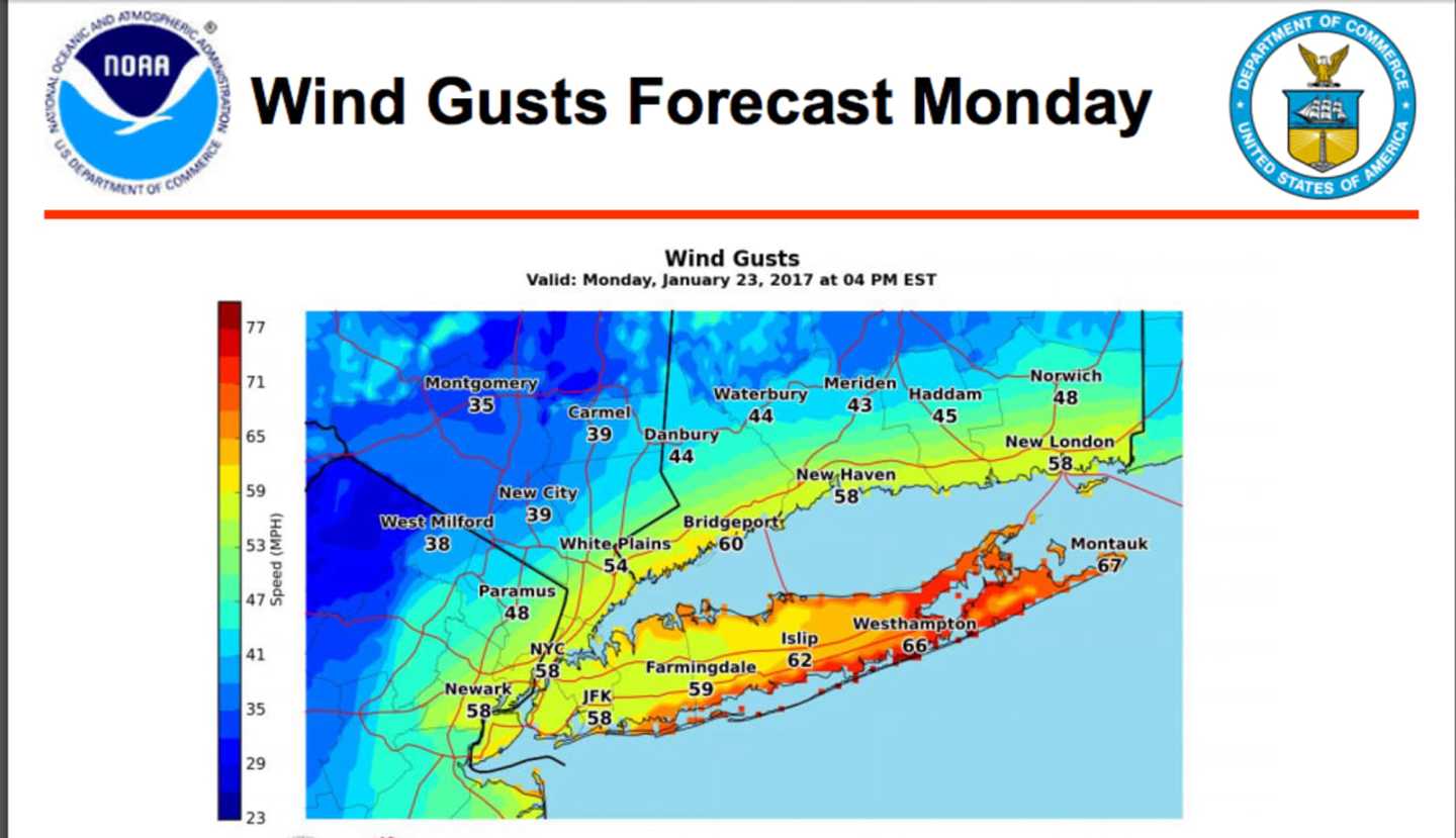
- High Wind Warning for NYC Metro, Long Island and Coastal Connecticut for late Sunday night into Monday night
- Coastal Flood Watch/Advisory for Western LI Sound, Long Island coastline, and portions of NY Harbor Monday morning and again late in the day
There is still uncertainty regarding the strength and track of the storm as well as precipitation amounts.
Check back to Daily Voice for updates.
Click here to follow Daily Voice Armonk and receive free news updates.