The National Weather Service has updated both its timeframe and snowfall predictions for the monster storm that will arrive in the area Saturday morning.
Snowfall is expected to start in most of the area earlier than originally expected. It is now projected to begin sometime in the early morning hours around dawn Saturday in parts of the area, particularly farthest south, and by later in the morning or early afternoon elsewhere. Snow should wind down in the early evening hours Saturday in most of the area.
The accelerated pace of the storm now means Sunday will be a mostly sunny day with highs in the mid 30s.
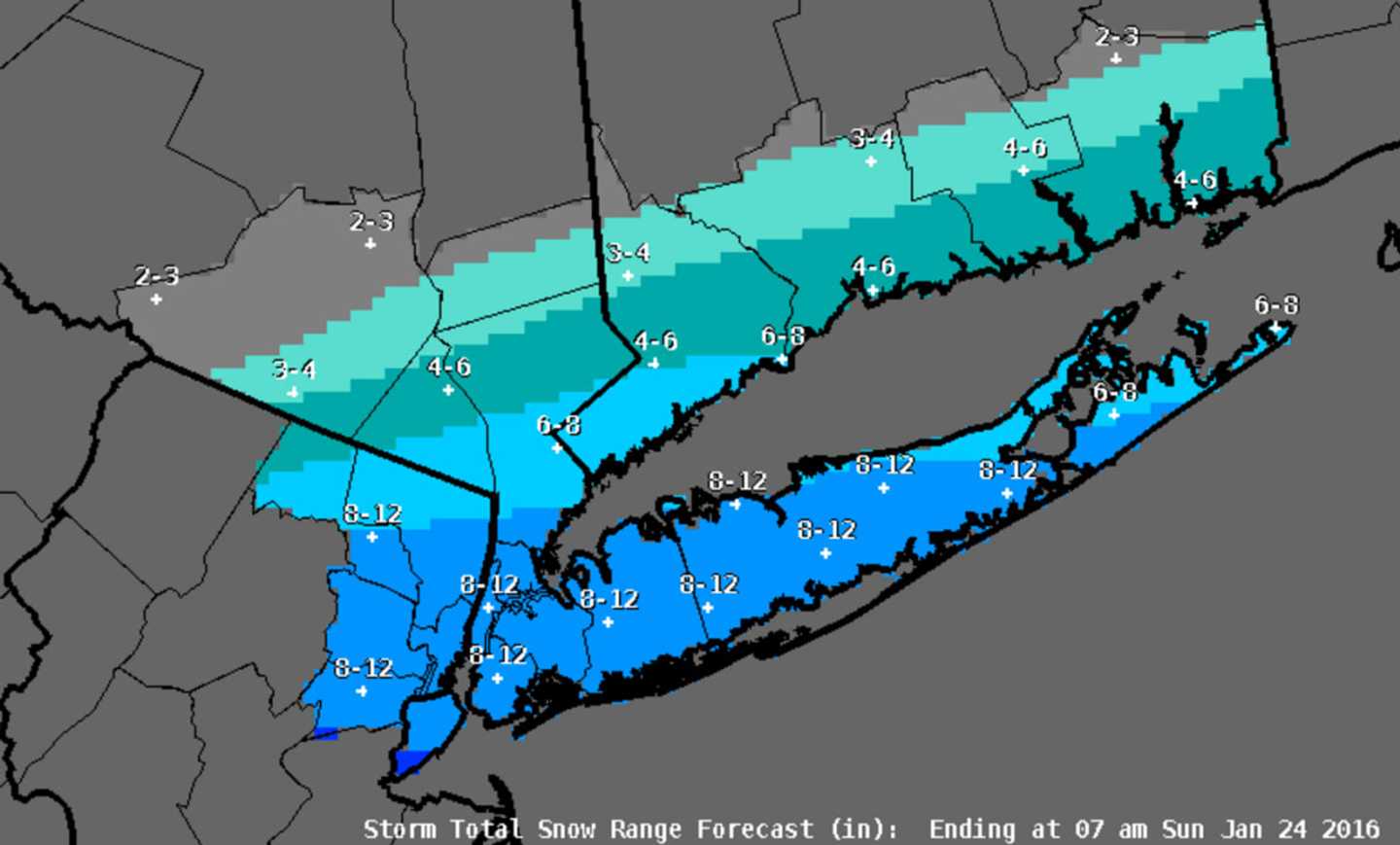
The main change affecting the Hudson Valley is an increase in the snowfall projection for much of Westchester and Rockland to between 4 and 8 inches, except for the northern-most parts of both counties. Southern-most Westchester could see between 8 and 12 inches of accumulation.
Forecasters are predicting lesser amounts of snow for those in the northern parts of the Westchester, Putnam, Rockland and Dutchess region. In fact, Dutchess could see little accumulation.
All of Westchester, Putnam and Rockland are now under a Winter Storm Warning.
The warning, originally scheduled to take effect at 6 a.m. Saturday, has been pushed up to 4 a.m. It was originally scheduled to expire at 1 p.m. Sunday. But now is scheduled to end at 7 a.m. Sunday.
Coastal flooding at high tides expected in Southern Westchester.
There is no watch or warning in effect for Dutchess.
Strong gusty of between 50 and 60 miles per hour are expected along coastal areas with power outages possible.
Check back to Daily Voice for updates.
Click here to follow Daily Voice Armonk and receive free news updates.