Find Your Daily Voice
 48°
48°
Latest Forecast Says Jersey Shore Towns Could Be Walloped With Most Snow In NJ (Details)
After several storms brought rain, wind, and wintry weather to the Jersey Shore to start 2024, cities and towns are bracing for what could be the heaviest snowfall along the coast so far this winter.
Parts of South Jersey could see up to six inches of snow on Friday, Jan. 18 — the highest amounts predicted across all of the the Garden State, according to the National Weather Service.
Burlington, Camden, Gloucester, Monmouth, Ocean, and Salem counties are under a winter storm warning until 10 p.m.
⚠️❄️ Forecast snowfall totals have increased slightly across the area. Snow will beg…
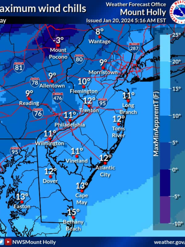
New Forecast: Increased Snowfall Totals Expected, Arctic Temps To Follow Northeast Storm
Newly-released forecast maps show parts of the region could see up to six inches of snow in the end-of-week storm.
Intermittent snow is expected to begin between 4 and 7 a.m. Friday, Jan. 19, with the heaviest amounts falling in the afternoon, the National Weather Service said.
Snow will fall at about 0.5 inches per hour and will taper by the evening, with temps in the upper 20s and low 30s, the NWS said.
SNOWFALL PREDICTIONS
The areas expected to get 4 to 6 inches are Trenton, Long Branch, Allentown, and Philadelphia. Reading, Vineland, Parsippany and Toms River are expected to get 3 to …
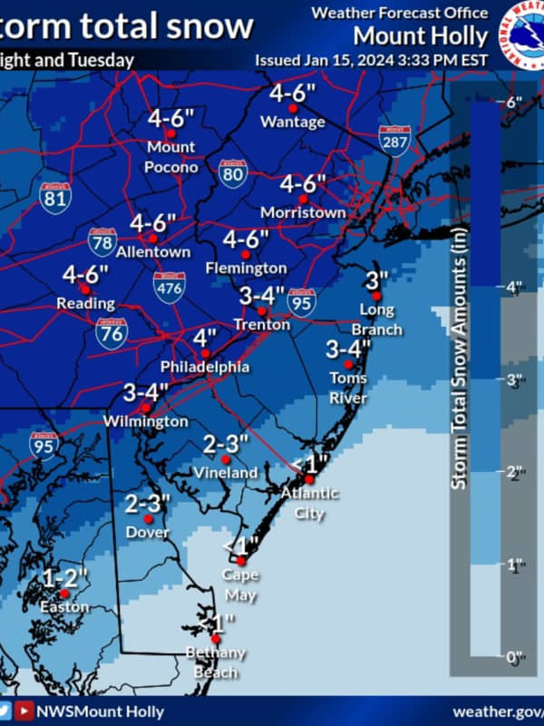
Six Inches Of Snow Could Slam Parts Of NJ, PA: Latest Forecast, Timing Updates
Newly-released forecast maps from the National Weather Service show up to six inches of snow could fall across eastern Pennsylvania and much of New Jersey.
Accumulating snowfall will begin Monday, night Jan. 15, mainly after 7 p.m., and carry into Tuesday morning, Jan. 16, impacting the morning commute as it changes over to a wintry mix, the NWS said in its latest briefing.
ALSO SEE: North Jersey School Delays For Tuesday, Jan. 16
Between 4 and 6 inches of snow was being forecast for most of North Jersey (including Morris, Sussex, pars of Bergen/Essex/Hudson, Warren, and Hunterdon Counties…
Possibility Of Snow, Ice Storm For Northeast Next Week Hinges On One Factor: AccuWeather
A winter storm could hit the Northeast next week, but it depends on one factor, forecasters say.
A dip in the jet stream.
“Should a large dip develop in the jet stream, then a major winter storm will climb the Atlantic coast from Monday night to Tuesday night,” AccuWeather Senior Meteorologist Bob Smerbeck explained.
“However, should only a shallow dip in the jet stream develop, the storm would be more likely to escape out to sea, off the southern Atlantic coast by midweek.”
Weather maps show a dusting of between one and three inches, should the snow make its way up to New Jersey, eastern…
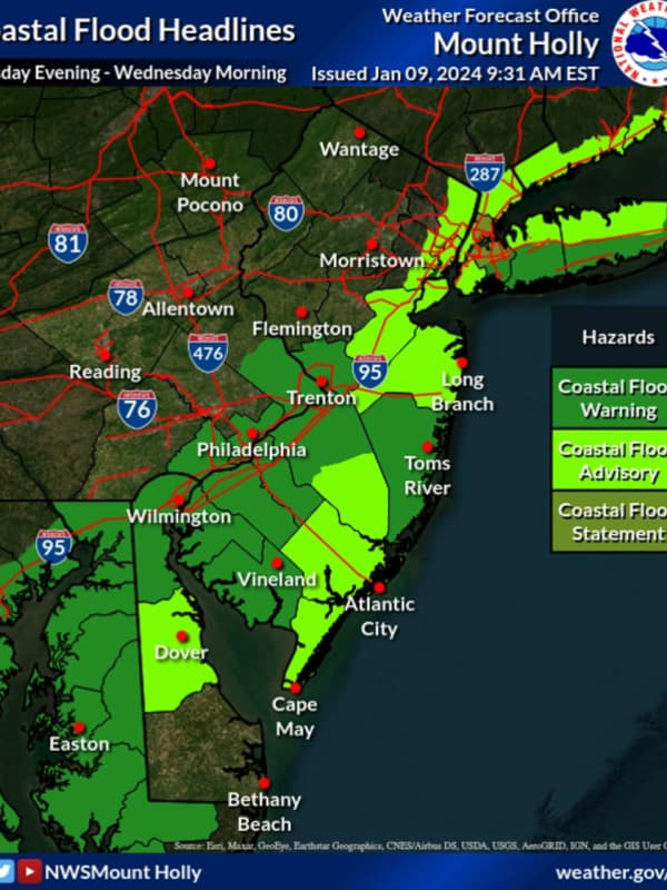
Flood Advisory In Effect For Ocean County
Thousands of New Jersey residents were without power as of Tuesday evening, Jan. 9, as the storm intensified.
A State of Emergency ordered by Gov. Phil Murphy went into effect at 5 p.m., with state and local officials urging residents to stay off the roads.
As of 7:25 p.m., more than 2,000 residents in Hunterdon County were in the dark, according to JCP&L, including 123 in Delaware; 729 in Lambertville City; 733 in Raritan; 437 in West Amwell, and more.
In Morris County, 3,360 JCP&L customers were without power. Those are residents of Mount Olive where 2,449 people w…
Tracking Major Mid-Week Winter Storm Set To Blast Region With Heavy Wind, Rain
A new winter storm on the heels of the last is set to blast the Northeast with heavy rain and winds, the National Weather Service said.
Monday, Jan. 8 will be sunny with a high in the mid-40s and Tuesday, Jan. 9 will be even warmer and breezy, with a high near 50, but with a chance of rain, the NWS said.
That rain is set to begin around 1 p.m., and will be accompanied by heavy winds as the day progresses, forecasters say. The NWS imposed a wind advisory beginning the evening of Jan. 9 for much of the Northeast.
Between 1 and 3 inches of rain is expected to fall in across the entire region,…