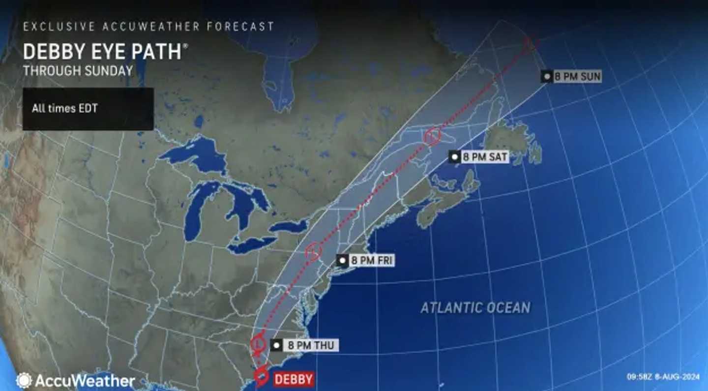
The AccuWeather map shows that Debby's path has taken a westward shift, and is set to work its way through northern Maryland then Eastern Pennsylvania Friday, Aug. 9 into Saturday (after moving through the Carolinas Thursday, Aug. 8).
Tornadoes are the main threat and severe thunderstorms are possible, the National Weather Service said.
"A more inland track of the remnants of Debby places our region in the more favorable zone for the tornado risk," the NWS said.
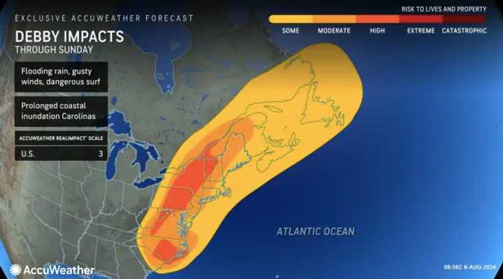
Increased threats of flash-flooding is also likely, the NWS said, as Debby comes on the heals of a storm that dropped several inches of rain on the Northeast.
Debby's increasing speed poses a limiting factor for rainfall, AccuWeather says. Virginia and eastern Virginia will see between 4 and 8 inches of rain, while Central Maryland, much of Pennsylvania, could see up to a foot.
The National Weather Service said the local magnitude of Debby's impacts could change depending on how the storm tracks.
Click here to follow Daily Voice Hackensack and receive free news updates.