Rain is expected to begin across both states Tuesday evening, Feb. 27, and continue through Wednesday morning, Feb. 28, the National Weather Service says.
While temperatures on Wednesday could reach a high of 60, a steep drop is expected in the evening to around 30, meaning rain could turn to snow in northwest New Jersey, the Lehigh Valley, and in parts of Central PA, according to the NWS.
The NWS State College says hail is possible late Tuesday night.
The NWS Philadelphia/Mount Holly warned of strong winds up to 40 or 50 mph, and urged residents to secure any loose items outdoors.
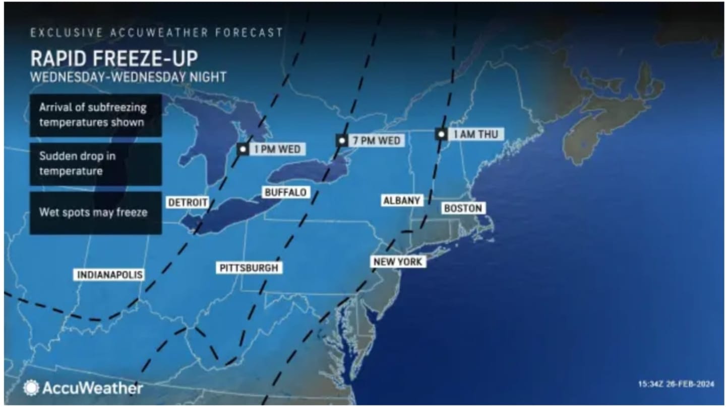
The deep-freeze also means slick roads come Thursday morning. AccuWeather says motorists "should closely monitor temperatures and be on the lookout for icy patches. Surfaces that appear wet may be icy, where the temperature has dropped to near or below the freezing mark.
"Bridges and overpasses are most likely to become icy, as these surfaces will cool the fastest, but there will be some exceptions."
Thursday morning will be sunny with a high near 40.
Click here to follow Daily Voice Gloucester and receive free news updates.