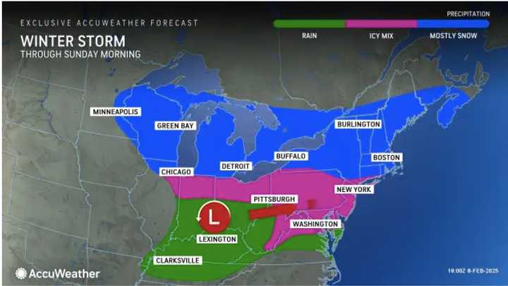
The storm moved from the Midwest to the East Coast on Saturday night, Feb. 8.
Overnight, the heaviest snowfall occurred inland in New York, New Jersey, Pennsylvania, Connecticut, Rhode Island, Massachusetts, and northern New England, where accumulations reached between 6 inches to a foot by Sunday morning.
In areas farther south with less snowfall, ice has created dangerous conditions and caused scattered power outages.
Sunday will be sunny and cold, with skies clearing in the evening.
A cold week ahead will set the stage for a pair of potential new storms.
The next system is expected to arrive on the East Coast Tuesday afternoon, Feb. 11, bringing a wintry mix and some snowfall farther north, according to the National Weather Service.
Following this, another storm is predicted for Wednesday night, Feb. 12, into Thursday, Feb. 13, though it is too early to estimate snowfall amounts, AccuWeather says.
Check back with Daily Voice for updates.Check back to Daily Voice for updates.
Click here to follow Daily Voice Holliston and receive free news updates.

