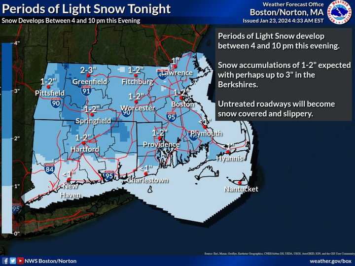
The time frame for the system is Tuesday, Jan. 23 into Wednesday, Jan. 24, according to the National Weather Service.
Brand-new snowfall projections through 7 a.m. Wednesday are shown in the image above from the National Weather Service. Areas in the darkest shade of blue could is up to 3 inches of accumulation.
Areas farther south shown in sky blue, especially in coastal Connecticut, are expected to see mainly a wintry mix, with little or no accumulation.
It will be cloudy throughout the day Tuesday with a high temperature generally in the mid-30s.
Farther north and and inland, light snow will develop late in the afternoon into Tuesday evening.
The light snow will come to an end early Wednesday, but pockets of light freezing rain/drizzle will impact the interior high terrain during the day Wednesday, the National Weather Service said, noting that untreated roadways may be slippery Tuesday night into Wednesday.
Wednesday's high temperature will be in the upper 30s.
Rainy weather will continue on both Thursday, Jan. 25, and Friday, Jan. 26 with a high temperature in the mid-40s both days.
It will finally dry out during the day on Saturday, Jan. 27 which will be partly sunny with a high temperature in the mid-40s before unsettled weather returns overnight.
Check back to Daily Voice for updates.
Click here to follow Daily Voice Hartford and receive free news updates.
