
That will come after a rainy start to the day on New Year's Eve Day, Thursday, Dec. 31. Rain will taper off by mid-morning, and it will stay cloudy the rest of the day with the high temperature in the mid 40s.
It will gradually become clear after nightfall on New Year's Eve. The overnight low will be in the mid 20s after the ball drops in Times Square, according to the National Weather Service.
New Year's Day, Friday, Jan. 1 will start off with some sunshine on a colder day in which the high temperature will be in the upper 30s, with wind-chill values between 20 and 30 degrees.
The first storm system will arrive at around nightfall Friday, and last into Saturday morning, Jan. 2 with a wintry mixture of rain, freezing rain, snow, and sleet.
New York City, the surrounding immediate northern suburbs, and Long Island will see mainly rain with some sleet at times.
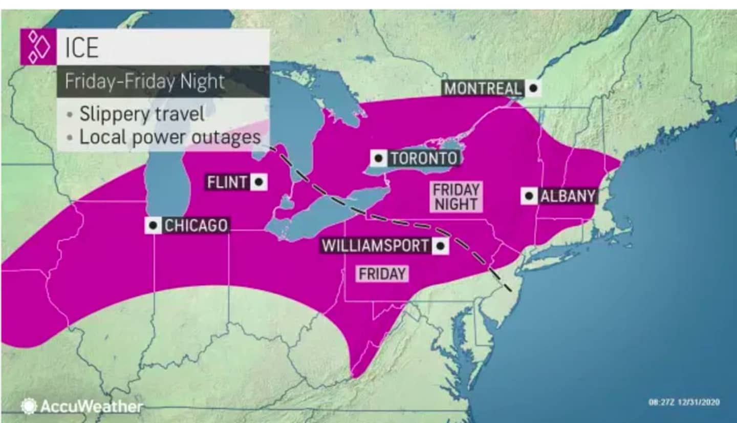
For a look at areas expected to see slippery travel later in the day on New Year's Day into Saturday, see the first image above.
Up to 6 to 12 inches of snowfall is possible in part of northernmost New England. (See second image above.)
That system will wind down by around 9 a.m. Saturday and temperatures will climb, with the high temperature reaching around 50 degrees, as clouds give way to afternoon sunshine.
Sunday, Jan. 3 will be mostly cloudy with a high temperature in the mid 40s and a chance for showers as the second separate storm system is forecast to approach Sunday night.
There will be a mix of rain, sleet, and snow showers overnight into Monday, Jan. 4.
Skies will clear Monday morning and it will become mostly sunny with a high temperature in the low 40s.
Check back to Daily Voice for updates.
Click here to follow Daily Voice Trumbull-Monroe and receive free news updates.