

Unlike the days-long Nor'easter that began on Monday, Feb. 1, this one will be a quick-moving system.
The current time frame for snow is from just after daybreak to around nightfall on Sunday, just as Super Bowl LV is set to kick off in Tampa, Florida.
Current projections call for generally 3 for 6 inches of snowfall on Sunday, Feb. 7 with higher amounts along the coast. Many areas farther north and west will be spared significant snowfall, with generally 1 to 3 inches of accumulation predicted there. But a shift of the storm track inland could result in heavier precipitation in those areas.
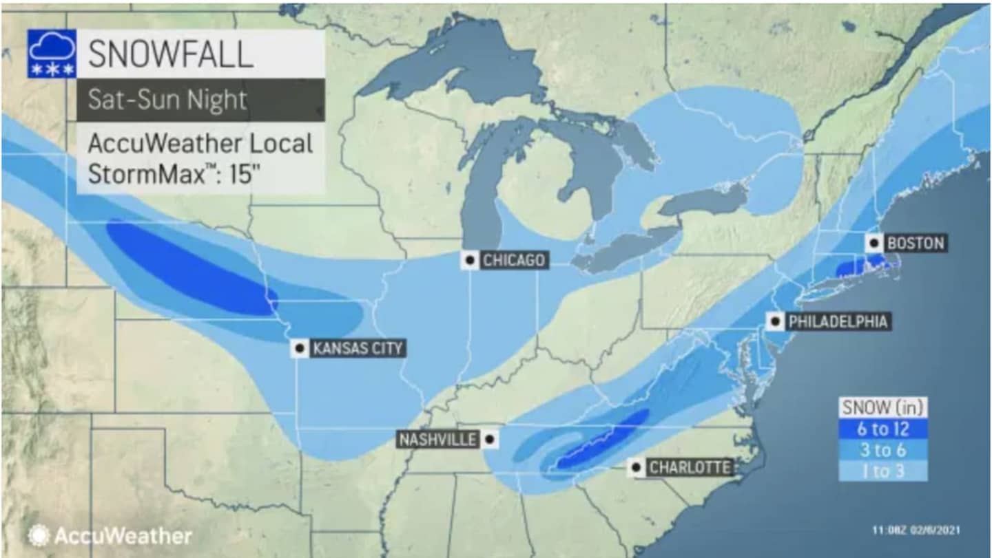
See the first image above to view snowfall projections for the entire Northeast.
Higher totals are likely on Long Island and coastal Connecticut, where 7 to 9 inches are now expected, according to projections by the National Weather Service released Saturday morning, Feb. 6.
For a look at projections for those areas expected to see the most snowfall, click on the second image above.
A Winter Storm Warning is in effect for the New York City metro area, Long Island, Connecticut, and northeast New Jersey from 6 a.m. to 9 p.m. Sunday, where travel could be very difficult, and snowfall rates may exceed 1-plus inches per hour for a period during the late morning and early afternoon, where snowfall bands with rates of 2-plus inches an hour are also possible.
Ahead of the storm, Saturday will be sunny with a high temperature in the mid 30s. But strong winds with gusts up to 25 miles per hour will make it feel like it's between 15 and 25 degrees.
Clouds will increase overnight with the temperature dropping to the low 20s
After a sunny and frigid day on Monday, Feb. 8, with a high temperature of around 30 degrees, the next chance for snow will come during the day on Tuesday, Feb. 9. Currently, a coating to an inch of snow is possible Tuesday morning into around midday.
Check back to Daily Voice for updates.
Click here to follow Daily Voice Trumbull-Monroe and receive free news updates.