Ernesto, which was upgraded to a tropical storm on Monday afternoon, Aug. 12, now heading through the Leeward Islands before it makes its way into the Virgin Islands and Puerto Rico by late Tuesday, Aug. 13, the National Hurricane Center..
AccuWeather says it could become a Category 1 hurricane as soon as Tuesday before likely strengthening to a Category 3 hurricane in the Atlantic by Thursday, Aug. 15.
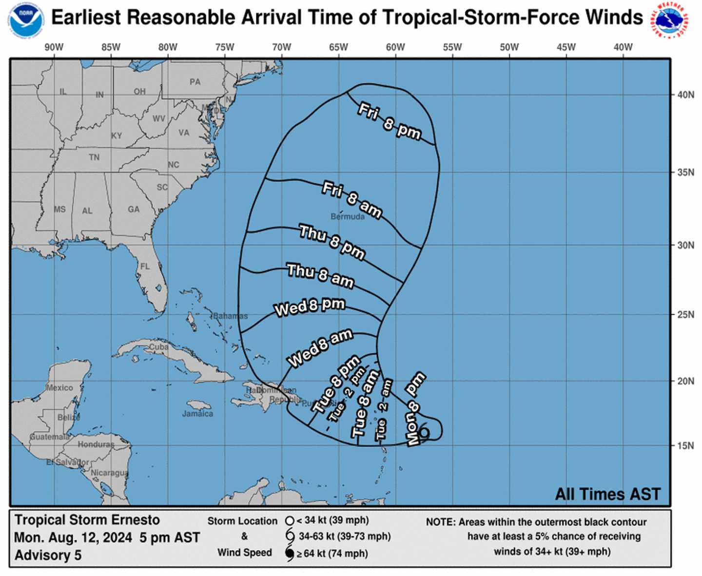
The projected timing and track of the tropical rainstorm through Friday evening, Aug. 16, is shown in the image above, just released late Monday by the National Hurricane Center.
The rainstorm is "forecast to intensify and bring heavy rainfall, gusty winds, and storm surge to parts of the Lesser Antilles, Puerto Rico, and the Dominican Republic this week," according to a statement by AccuWeather.com.
Formation chance through 48 hours is high at 70 percent and through seven days even higher at 90 percent, the National Hurricane Center said.
"After moving through the islands, the storm is forecast to be pulled to the north by a southward dip in the jet stream," AccuWeather Lead Hurricane Expert Alex DaSilva said. "The storm may continue to intensify and could become the second major hurricane of the season by the end of this week."
This continues to be a developing story. Check back to Daily Voice for updates.
Click here to follow Daily Voice Shelton and receive free news updates.