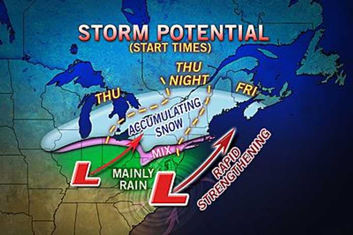
The storm will start of as rain or a mix of rain and snow before turning over completely to snow, according to Accuweather senior meteorologist Paul Walker.
“As far as we can tell, Fairfield County will get around three to six inches of snow,” said Walker.
The forecast could change, however, depending on how fast the rain changes to snow, he said. Blizzard-type conditions will take place further to the northeast in places like Maine, he said. “Western New England won’t be in the worst of this storm.”
The storm is likely to hit a high point Friday evening around rush hour and stay strong through Friday night, Walker said.
Snow accumulations will vary, Walker said. “I would say that the places along the coast are more likely to see more rain, but further north will have more snow,” Walker said. He added that a more detailed forecast will be available as storm gets closer to the area.
The two storms, a fast-moving cold front from Canada and warm moist air from Texas, are expected to come together off the coast of New Jersey.
Click here to follow Daily Voice Norwalk and receive free news updates.
