Tuesday, Jan. 22 will be mostly sunny with a high in the mid- to upper-20s and the overnight low in the upper teens.
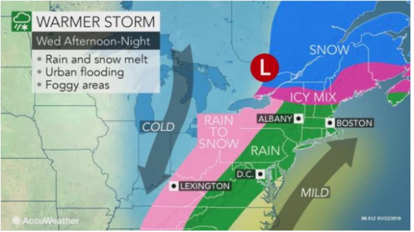
The storm will arrive along with a brief surge of warmer air. Rain is expected sometime after 2 p.m. on Wednesday, Jan. 23 on a mostly cloudy day with a high in the low-40s and wind-chill values between 20 and 30.
The warmer air continues Thursday, Jan. 24 and so does the rain. There's a 90-percent chance of rain with the high temperature expected to climb to the mid- to upper-40s. The storm should wrap up by around 5 p.m. Thursday.
Colder air will return overnight with a low around 22 degrees.
Friday, Jan. 25 will be mostly sunny with the high temperature around freezing.
A new Arctic blast will be in full force overnight Friday into Saturday, Jan. 26 with the low temperature dropping to around 12 degrees.
Saturday will be mostly sunny with a high in the mid-20s.
There's a chance for snow on Sunday, Jan. 27 on a cloudy day with a high around 32 degrees.
Check back to Daily Voice for updates.
Click here to follow Daily Voice Norwalk and receive free news updates.