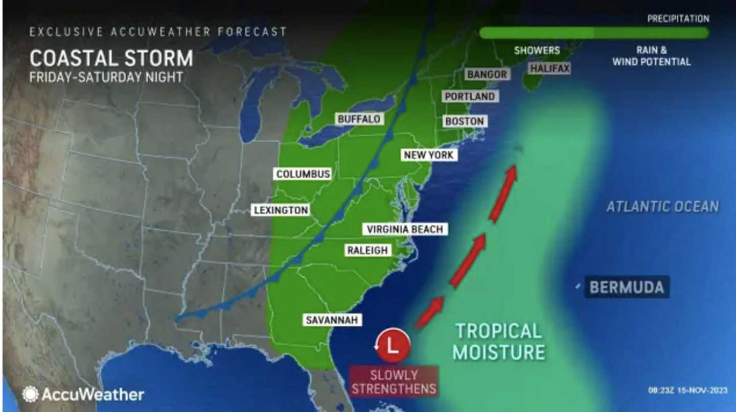
The time frame for the system is from Friday, Nov. 17 to Saturday, Nov. 18, according to the National Weather Service.
Ahead of the arrival of the storm, Wednesday, Nov. 15 and Thursday, Nov. 16 will both be sunny and dry.
It will be cooler on Wednesday with a high temperature of around 50 degrees.
The mercury will climb to a high in the upper 50s to around 60 degrees on Thursday as an "area of high pressure, which has been the culprit behind unseasonably cold nights across the Northeast, will finally shift off the coast," AccuWeather Senior Meteorologist Brett Anderson says.
Skies will be partly sunny during most of the day on Friday with a high temperature in the low 60s.
As the storm nears, there will be a slight chance of rain in the afternoon, before steady rain arrives at night. Up to a half-inch of rainfall is possible overnight.
Rain will wind down from west to east starting after daybreak on Saturday. It will remain cloudy throughout the morning before there is gradual clearing in the afternoon.
The passage of the storm and cold front will be followed by cooler temperatures. The high will be in the low-50s on Saturday and upper-40s on Sunday, Nov. 19.
Skies will be mostly sunny on Sunday.
Check back to Daily Voice for updates.
Click here to follow Daily Voice New Canaan and receive free news updates.