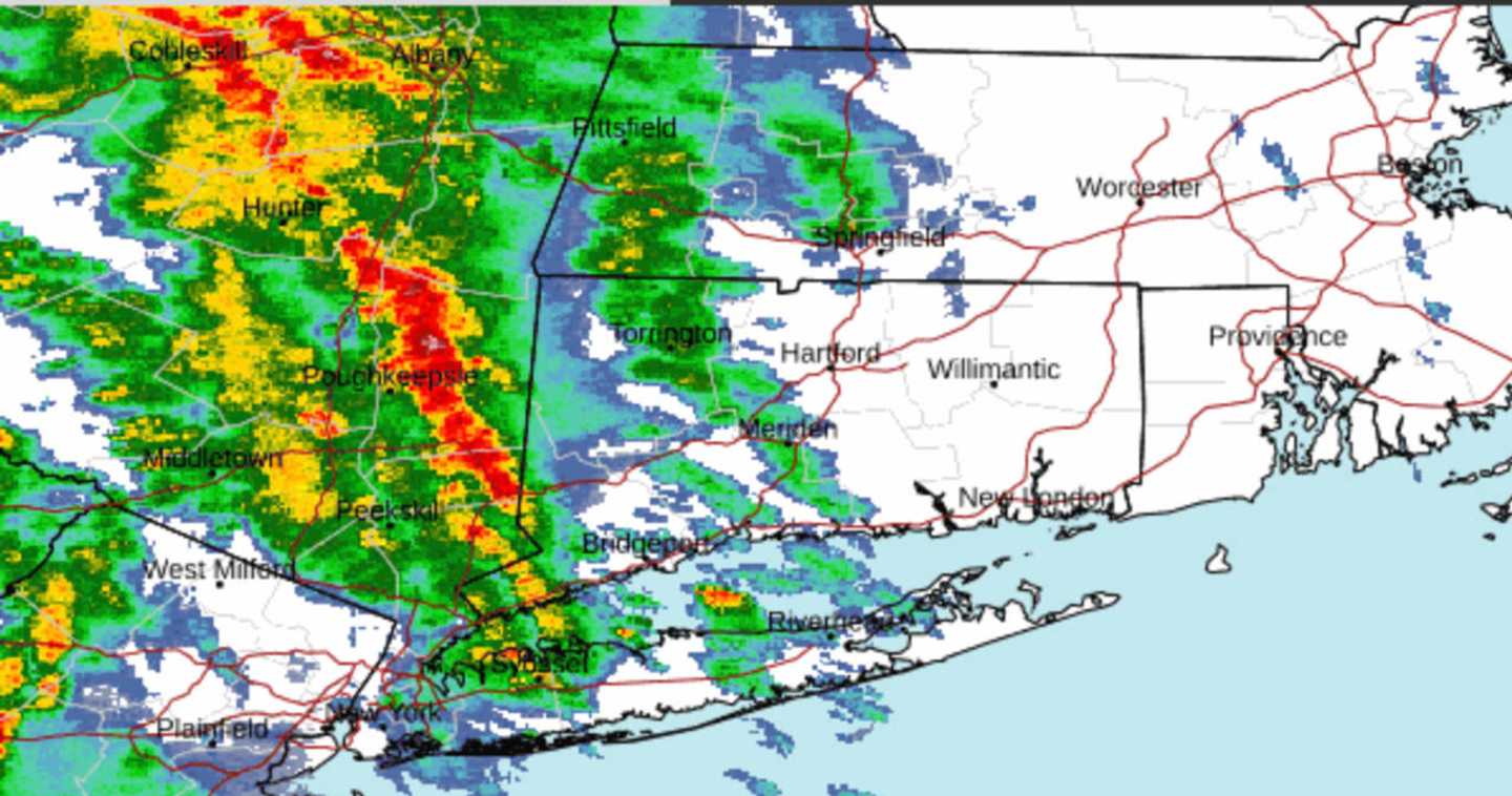
The radar image above was taken at about 7 a.m. Wednesday, May 8, shows some severe storms (marked in red).
Scattered storms will persist through the morning and afternoon with some sun, pushing temperatures to the upper 70s to low 80s.
Coastal flooding is expected from late Wednesday night into early Thursday morning, May 9.
"Some roads and low-lying properties, including parking lots, parks, lawns, and homes and businesses with basements near the waterfront, will experience minor flooding," the National Weather Service said in a statement issued Wednesday morning.
Additional coastal flooding is expected for high tide cycles on Thursday and Friday night, May 10.
Skies will become partly cloudy overnight into Thursday morning, before a new chance for showers and scattered storms in the afternoon into Thursday evening.
Thursday's high temperature will be around 70 degrees.
Clouds will linger on Friday, which will be cooler. High temperatures will be in the mid-50s, and there is a chance for spotty showers.
The weekend will be dry mainly and pleasant with partly sunny skies on Saturday, May 11, and a high temperature in the low 60s.
There will be a mix of sun and clouds on Sunday, May 12 with high temperatures again in the low 60s.
Pop-up showers are possible during the day.
Check back to Daily Voice for updates.
Click here to follow Daily Voice Greenwich and receive free news updates.