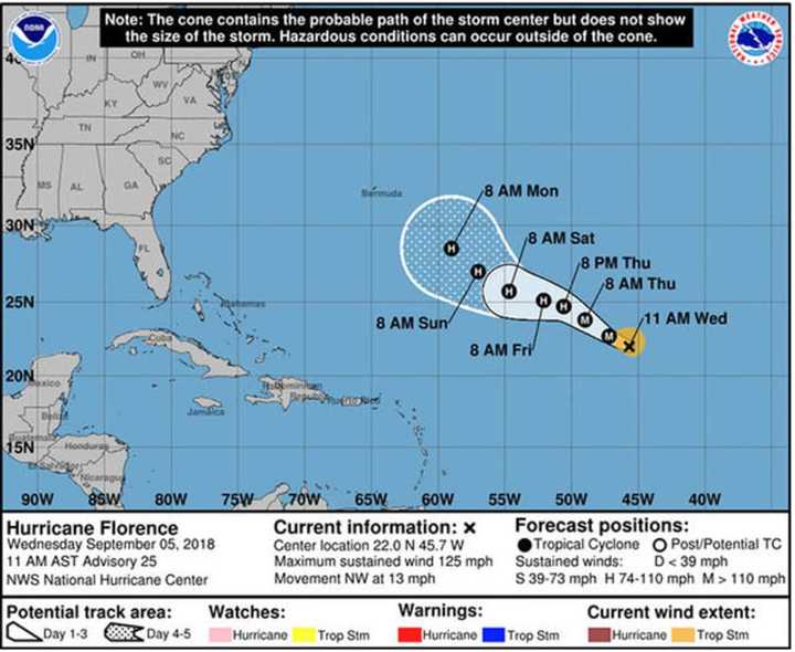
So-called "spaghetti models" (see image above) show potential paths for what is now a Category 2 hurricane packing maximum sustained winds of 120 mph, with its eye located about 1,400 miles east of Bermuda.
If Florence's track takes its farther west, it could push toward the East Coast with possible impacts on the area next Wednesday and Thursday.
"An area of high pressure over the central Atlantic will bridge westward and join with an existing high pressure near the U.S. East Coast over the next several days," AccuWeather Hurricane Expert Dan Kottlowski said. "This setup will guide Florence on a west to northwesterly course into next week."
The best-case scenario would be for Florence to track more to the north, staying east of Bermuda and in the open waters of the central Atlantic into next week.
The current projected path by the National Hurricane Center for the next few days can be viewed in the second image above.
This is still much uncertainty surrounding Florence's path for next week.
Check back to Daily Voice for updates.
Click here to follow Daily Voice Darien and receive free news updates.

