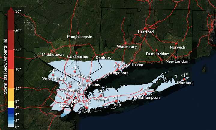
But there's good news. The tristate area will be spared from the storm's wrath when it arrives in the Northeast on Monday morning, Jan. 6.
The latest snowfall projections from the National Weather Service call for around a trace of snow in this region. That's lower than earlier predictions of up to 2 or even 3 inches. (See the image above.)
"It's possible there may not even be a trace of snow as well," the weather service said in releasing the new projections on Sunday afternoon, Jan. 5. "While this one model representation of the snow covers much of the area, it's very possible the snow stays south and not much snow falls at all."
The bulk of the snowfall is expected in the Washington, DC area as well as southern New Jersey and southern Pennsylvania.
Sunday night will be cold and breezy with low temperatures in the low to mid 20s.
High temps Monday will only break freezing by a few degrees along coastal areas, while interior locations will peak around freezing.
As temperatures drop Sunday night, they may not rise back above freezing until Friday, Jan. 10.
Check back to Daily Voice for updates.
Click here to follow Daily Voice Darien and receive free news updates.
