
Locally strong to potentially damaging winds are also possible from the system, which will move through Thursday afternoon and evening, Oct. 13, according to the National Weather Service.
A widespread 1 to 1.5 inches of rain is expected, with locally higher amounts possible, the weather service said.
"The main threat from this rainfall is minor urban and poor drainage flooding. Localized flash flooding is possible, especially Thursday evening."
The storm system is expected to arrive mid-afternoon Thursday, on a day in which the high temperature will be in the mid 60s.
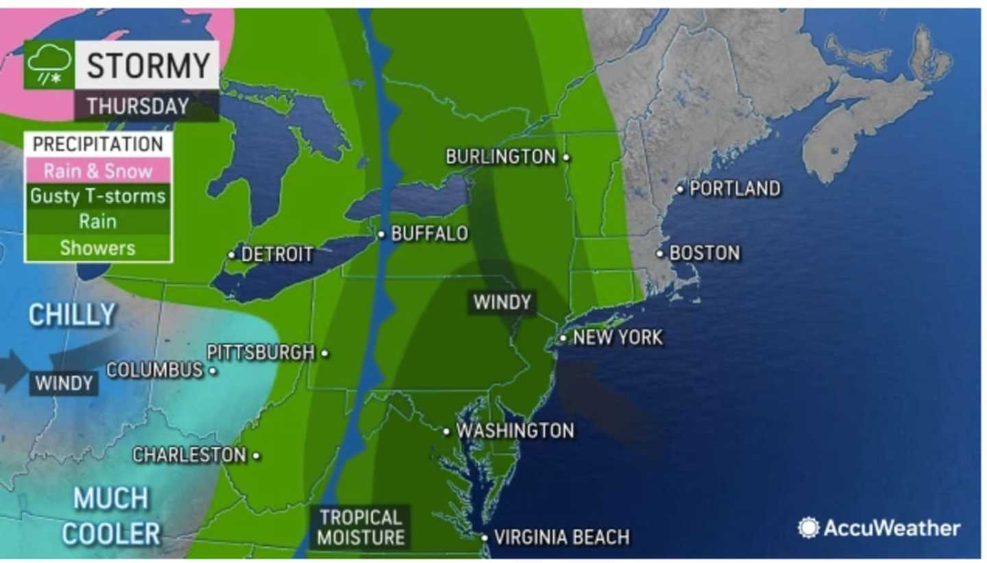
The heaviest rainfall is expected after nightfall on Thursday. (See the first image above from AccuWeather.com.)
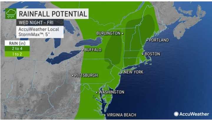
For a look at areas expected to receive the most rainfall, click on the second image above. Areas in dark green could see 2 to 4 inches of precipitation.
Widespread wind gusts as high as 30 miles per hour are expected Thursday afternoon and evening, with some areas seeing 55 to 65 miles per hour, according to AccuWeather.com. (Click on the third image above.)
The system will push out overnight, leading to a mostly sunny day on Friday, Oct. 14 with a high temperature in the low to mid 60s.
The weekend looks to be mostly sunny and dry with a high temperature in the upper 60s on both Saturday, Oct. 15, and Sunday, Oct. 16.
Check back to Daily Voice for updates.
Click here to follow Daily Voice Arlington and receive free news updates.