According to the National Weather Service, the Alberta Clipper system's time frame is Wednesday night, Dec. 4, to Thursday, Dec. 5.
After forming in Alberta, Canada, on Sunday, Dec. 1, it will travel near Lake Superior from Monday, Dec. 2 to Tuesday, Dec. 3 before pivoting east, AccuWeather says.
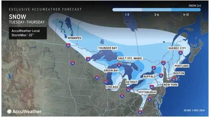
In locations in the lightest shade of blue in the image above from AccuWeather, a widespread 1 to 3 inches of snowfall is expected, with areas farther inland expected to see 3 to 6 inches.
Some spots (shown in the darkest shade of blue), including parts of northern New York and western Pennsylvania, could see 6 inches to a foot.
The days leading up to the arrival of the system will be brisk.
Monday will be mostly sunny, with temperatures in the upper 30s to low 40s and strong winds.
It will remain cool and dry on Tuesday with mainly sunny skies.
After a partly sunny start, clouds will increase during the day on Wednesday. Widespread snow showers will arrive after nightfall as the system moves from west to east.
Check back to Daily Voice for updates.
Click here to follow Daily Voice Purcellville and receive free news updates.
