-
by
Joe Lombardi
Weather
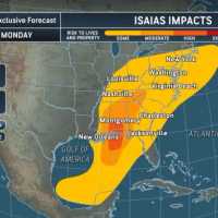
The Atlantic season’s first hurricane is targeting the Gulf Coast, but it could reach the Northeast before the weekend is over.Isaias reached hurricane strength late Wednesday, Oct. 7, with maximum sustained winds of 75 mph, the National Hurricane Center reported after an Air Force Reserve aircraft investigated the storm.
NOAA satellite imagery shows Isaias over the Gulf late ...
-

by
Joe Lombardi
National Interest
A surge of tropical moisture unleashed by Hurricane Erin is set to drench the Northeast with meteorologists warning that sudden, drenching downpours could trigger dangerous flash flooding from Virginia to New England on Wednesday, Aug. 20.Tropical air funneled northward by Hurricane Erin is colliding with a stalled weather front, setting the stage for intense rainfall and the risk of ...
-
by
Cecilia Levine
Weather
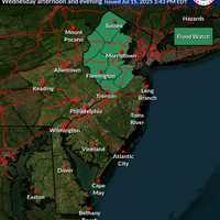
Just one day after a fast-moving storm swept through New Jersey, causing dramatic rescues, a home explosion, and multiple deaths, officials have issued both a Flood Watch and Heat Advisory for the region.The Flood Watch, issued by the National Weather Service in Mount Holly, warns that flash flooding is possible in seven New Jersey counties from Wednesday afternoon, July 16, through ...
-

by
Joe Lombardi
Weather
An increase in humidity will help fuel a new round of widely scattered thunderstorms that will sweep through the region.The time frame for storm activity is mainly after 3 p.m. until around 11 p.m. on Thursday, July 28.Areas with the best chances to see storms are southern Connecticut and Long Island, according to the National Weather Service.Thursday will be partly sunny for most of ...
-

by
Joe Lombardi
Weather
A dramatic swing in temperatures will mark a topsy-turvy week that will include the arrival of a new winter storm that will bring strong wind gusts to the region.The strong cross-county storm moving from the west to east will arrive in the Northeast on Thursday, Feb. 17.While this region is expected to be spared from snowfall, wind gusts of around 30 miles per hour are possible, the ...
-
by
Joe Lombardi
Weather
A dramatic swing in temperatures will mark a topsy-turvy week that will include the arrival of a new winter storm that will bring damaging wind gusts to the region.The strong cross-county storm moving from the west to east will arrive in the Northeast on Thursday, Feb. 17.While this region is expected to be spared from snowfall, "damaging wind gusts in excess of 60 miles per hour" are ...
-

by
Daily Voice
Breaking News
A powerful storm system bringing heavy downpours and damaging winds has resulted in numerous downed tree limbs, leading to road closures and tens of thousands of power outages in Connecticut.Here are the number of customers without power just after 8:30 a.m. on Christmas Day, Friday, Dec. 25, listed by utility company (click on each link for breakdowns by community):Eversource, ...
-
by
Daily Voice
Breaking News
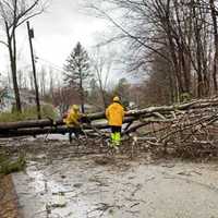
A powerful storm system bringing heavy downpours and damaging winds has resulted in numerous downed tree limbs, leading to road closures and more than 100,000 power outages in the Hudson Valley.Here are the number of customers without power just before 8:15 a.m. on Christmas Day, Friday, Dec. 25 by utility company (click on each link for breakdowns by community):Con Edison - 17,598NYSEG ...
-

by
Daily Voice
Breaking News
A powerful storm system bringing heavy downpours and damaging winds has resulted in numerous downed tree limbs, leading to road closures and power outages.Just before 8 a.m. on Christmas Day, Friday, Dec. 25 PSEG Long Island is reporting 8,194 customers without power as a result of 319 separate outages.Most of the outages are in Nassau County, where 6,513 were without power.In areas ...
-
by
Joe Lombardi
Weather
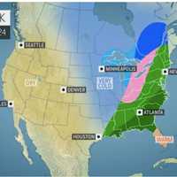
The National Weather Service has issued a Hazardous Weather Outlook statement for a powerful system that will sweep through the area on Christmas Eve, bringing drenching rain, thunderstorms, and damaging winds that could cause power outages.The time frame for the storm is Thursday night, Dec. 24 into Friday morning, Dec. 25."The combination of lingering snowpack and heavy rain may bring ...
-

by
Kristin Palpini
Weather
While snow continues to fall in the area on Thursday, Dec. 17, overnight snowfall totals were made available by The National Weather Service.The National Weather Service is warning commuters to be careful on roadways this morning.As of 7 a.m., here are the overnight snowfall totals for Thursday. Dec. 17:Hartford CountySimsbury - 11 inchesBradley Airport - 10.9 inchesCanton - 10.5 ...
-

by
Joe Lombardi
Weather
A new round of strong to severe thunderstorms and showers are expected to sweep through the area.The time frame for the scattered storms across eastern New York, Connecticut and western New England is in the afternoon into the evening on Thursday, July 23.Damaging winds and possible one-inch hail are the main threats with locally heavy rainfall possible, the National Weather Service ...
-

by
Joe Lombardi
Weather
A quick-moving, intensifying storm system will sweep through the area after nightfall, bringing a blast of snow to the region that could result in slippery travel and brief whiteout conditions.The storm will affect the area mainly Tuesday evening, Jan. 7, with the window for snowfall from between about 7 p.m. Tuesday to roughly 1 a.m. Wednesday, Jan. 8. The highest likelihood for ...
-

by
Jerry DeMarco
Breaking News
The founder of a nature tour company operating from the Jersey Shore north to Poughkeepsie and southern Connecticut was found with 6,800 photos and 120 videos of child sexual abuse, an indictment returned by a federal grand jury alleges.Federal Homeland Security agents arrested Vaughn Tiedeman, 46, of Living Adventure Tours, in February on distributing child pornography charges.A grand ...
-
by
Jerry DeMarco
Breaking News
The founder of a nature tour company operating from the Jersey Shore north to Poughkeepsie and southern Connecticut was caught with 6,800 photos and 120 videos of child sexual abuse, an indictment returned by a federal grand jury alleges.Federal Homeland Security agents arrested Vaughn Tiedeman, 46, of Living Adventure Tours, in February on distributing child pornography charges.A grand ...
-

by
Joe Lombardi
Weather
Get set for a stormy day.Some isolated storms developing in the morning on Wednesday, Aug. 21 will be just a preview of what's in store later on with stronger thunderstorms sweeping through in the afternoon and evening.Some of those storms will become severe, the National Weather Service said in a Hazardous Weather Statement issued on Wednesday morning covering southeast New York and ...
-

by
Zak Failla
Weather
A Red Flag Warning is in effect for the area is at a risk for brush and forest fires.Conditions are ripe for a fire to break out, according to the National Weather Service, which issued the warning on Thursday. The Red Flag Warning will be in effect from 10 a.m. to 8 p.m. in the area.According to the National Weather Service, a Red Flag Warning means that “critical fire weather ...
-

by
Joe Lombardi
Weather
Get set for a new round of severe storms.Late afternoon thunderstorms will once again bring downpours, lightning, gusty winds and possible flooding to the area.The line of storms is moving from west to east with torrential rainfall that may cause localized flooding. (See satellite image above.)Frequent cloud to ground lightning is occurring with this storm, according to the National ...
-

by
Joe Lombardi
Weather
Click here for an updated story: Projected Snowfall Totals Increase For Weekend StormEarlier report:A fast-moving storm system that will pass through the area Saturday night into Sunday morning is expected to bring accumulating snow, the National Weather Service said in a Hazardous Weather Outlook statement issued Thursday morning.The snow may mix with rain at the coast, said the ...
-

by
Joe Lombardi
Weather
It's one wet mess.A storm bringing drenching rain with downpours and a chance of flash flooding has arrived, and the question now is how long will it last?Moderate to heavy rain may produce urban and poor drainage flooding from late Saturday through Sunday night, especially in areas farther south, said the National Weather Service.There is also a low chance for minor flooding on some of ...
-

by
Joe Lombardi
Weather
There could be some slick conditions during the Friday evening commute with light snow and snow showers now falling in parts of the area.Little or no accumulation is expected.A new storm system will move through the area late Saturday afternoon through Sunday night, but temperatures will be warm enough -- in the upper 40s during the day and lower 40s at night -- to ensure all rain will ...
-
by
Joe Lombardi
Weather
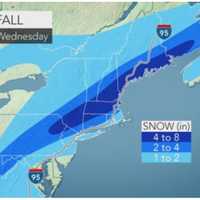
New Storm Update: How Much Snow Will You Get? Depends On Where You AreSnowfall projections for the latest winter storm heading to the tristate area have increased.A total of 3 to 5 inches in now expected for most of the region, with 6 inches or more north of I-84 through Wednesday morning.Motorists and pedestrians should plan on snow-covered roads, slippery road conditions and limited ...
-

by
Daily Voice
Weather
FAIRFIELD COUNTY, Conn. — Heavy rain combined with melting snow is in the forecast for Friday morning through Saturday, leading the National Weather Service to issue a Flood Watch for Fairfield County and all of Connecticut. The weather Thursday will be foggy and cloudy, with a high near 49. By nighttime, rain will move into the area with widespread fog.By Friday, moderate to heavy rain ...
-

by
Karen Tensa
Weather
FAIRFIELD COUNTY, Conn. — Now that the nor'easter has moved through Fairfield County, get ready for the temperatures to plunge. The National Weather Service issued a Wind Chill Advisory for Fairfield County — effective immediately — and running through 10 a.m. Saturday. "The dangerous wind chills will cause frostbite in as little as 30 minutes to exposed skin," the weather ...


