

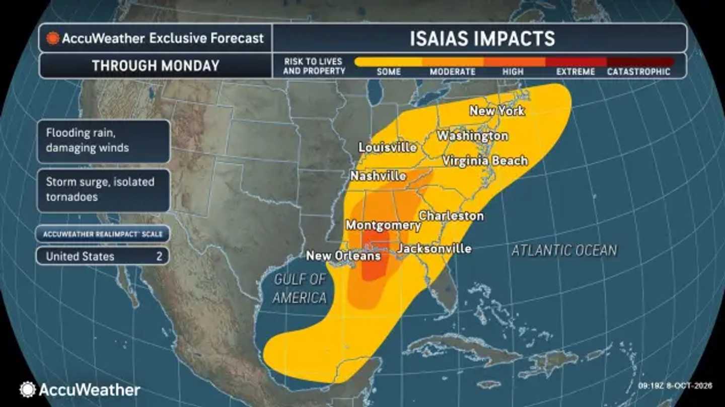


Isaias reached hurricane strength late Wednesday, Oct. 7, with maximum sustained winds of 75 mph, the National Hurricane Center reported after an Air Force Reserve aircraft investigated the storm.
For Northeast residents, the developing concern is rain from the weakening system as it moves inland and turns east.
The National Weather Service forecasts moderate to occasionally heavy rain Sunday, Oct. 11, into Monday, Oct. 12, across its region, which includes southeastern New York, northeastern New Jersey, and southern Connecticut.
Forecasters currently expect roughly 0.75 to 1 inch over about 18 hours. Those estimates have trended lower, and the system’s forward speed could limit heavier totals.
Coastal winds could briefly reach 20 to 30 mph Sunday night.
Pennsylvania lies along that broader inland-to-coastal corridor. Rainfall coverage farther north into Massachusetts will depend on the eventual track.
Farther south, the NWS Baltimore/Washington office expects rain to reach its Maryland and Virginia forecast area Sunday. Around 1 to 2 inches is possible, though amounts remain uncertain. Forecasters also said severe weather cannot be ruled out.
AccuWeather projects the weakening system could reach the Ohio Valley before crossing the Appalachians and moving offshore early next week. Downpours could cause localized flash flooding, particularly in steep terrain or where soil is saturated.
The strongest impacts remain focused farther south.
AccuWeather forecasts a Category 2 hurricane reaching the central Gulf Coast late Friday, Oct. 9, or early Saturday, Oct. 10.
“Our forecast track has the storm avoiding the strongest wind shear, which should foster strengthening,” AccuWeather Hurricane Expert Alex DaSilva said. “Since Isaias will be moving along with wind shear, in part, the inhibiting effect might be reduced.”
Local rainfall amounts and timing remain subject to change as Isaias approaches land.
Check back with Daily Voice for the latest updates.
Click here to follow Daily Voice and receive free news updates.
