Find Your Daily Voice
GO
Tag:
Driving Conditions
Union, NJ
Weather
Flash Flood Watch In Effect Across NJ, PA As Storms Threaten Roads, Power: NWS
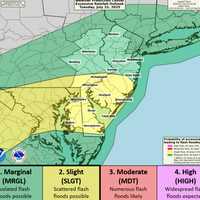
A powerful round of thunderstorms is expected to hit New Jersey and eastern Pennsylvania beginning Monday afternoon, July 14, with the National Weather Service warning of flash flooding, possible power outages, and dangerous driving conditions. The NWS in Mount Holly issued a Flood Watch that remains in effect through 2 a.m. Tuesday for large parts of the region. Some areas could see rainfall rates exceeding two inches per hour, with total accumulation of up to five inches in spots. Another round of storms is likely Tuesday afternoon, adding to the risk. According to forecasters, the greate…
Rocky Hill, CT
Breaking News
2 Hospitalized After Car Crashes Into Culvert Off I-91In Rocky Hill
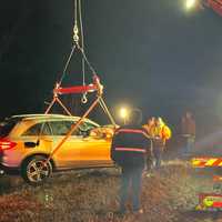
A car careened off I-91 in Hartford County early Saturday, landing deep in a drainage culvert and injuring multiple people, authorities said. Firefighters and Connecticut State Police were called to the single-car crash just north of Exit 23 in Rocky Hill around 2 a.m. They found the vehicle about 50 feet off the highway, with its occupants already trying to climb out as troopers assisted them up the embankment, authorities said. Both people inside were taken to a local hospital with injuries, though officials did not disclose their conditions. Heavy fog and dangerous driv…
Hackensack, NJ
Weather
4 Inches Of Snow Fell In Parts Of Bergen County: Here's How Much Your Town Got
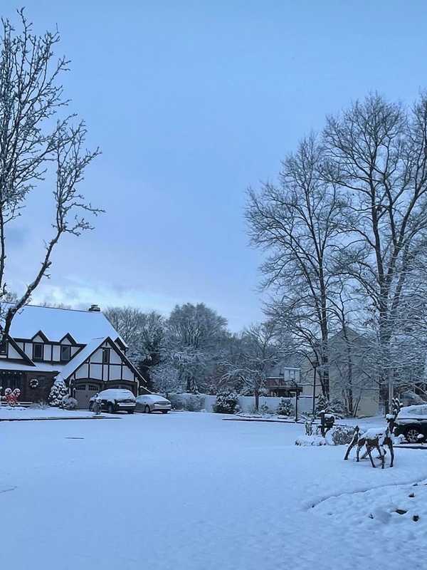
A winter storm dropped varying amounts of snow across New Jersey overnight Friday, Dec. 20, into Saturday morning, Dec. 21. Snowfall totals ranged from trace amounts in South Jersey to more than 5 inches in parts of North Jersey, creating slippery conditions on roadways as temperatures remained below freezing, according to data from the National Weather Service. Sussex and Morris counties recorded the highest snowfall, with Sparta Township leading at 5.5 inches and Randolph Township close behind at 5.3 inches. Meanwhile, southern counties like Atlantic and Cumberland reported only tra…
Worcester, MA
Weather
School Closings: List Grows As Nor'Easter To Bring Heavy Snows, High Winds
The National Weather Service has issued a hazardous weather outlook for Central and Western Massachusetts on Monday, March 15, through Wednesday as a nor'easter will blanket the area with heavy snows and high winds. Several schools have announced they will be closed on Tuesday. The Berkshires Adams-Cheshire Regional School District Berkshire Hills Regional School District Central Berkshire Regional School District Farmington River Regional School District Gabriel Abbott Memorial School Hancock Regional School District Lee Public Schools Mount Greylock Regional School District North Ad…
Massapequa, NY
Weather
Potentially Significant Storm Could Be Coming: Wintry Blast Will Bring Separate Snow Chances
A blast of wintry weather will lead to separate chances for snowfall through early next week, including what could be a more significant storm. Wind gusts will be as high as 30 miles per hour Saturday morning, Feb. 25 on a day in which the high temperature will be right around the freezing mark, but with wind-chill values in the teens, the National Weather Service says. There will be a band of light snow moving through from the late morning until the mid to late afternoon on Saturday. (See the first image above from AccuWeather.com.) Other areas could see a coating to an inch as well …
Worcester, MA
Weather
Snow, Rain May Make Roads Dangerous In Central, Western Mass: NWS
The National Weather Service has issued a Winter Weather Advisory for most of Massachusetts for Friday, Jan. 6, as freezing rain overnight is expected to turn to snow by mid-morning, which could make driving conditions dicey. Forecasters said most of western and central Massachusetts should expect a mix of snow and rain for most of the morning before cold air moves in from the north eliminating the rain. Most areas will receive an inch or more of snow, but higher elevations in Franklin, Worcester, and Middlesex counties could receive between two-to-five inches. National Weather Service …
Gettysburg, PA
Breaking News
Snowfall Projections Released For This Week's Storm In Pennsylvania
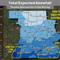
The first winter storm of the year is expected to bring snow and more cold temperatures that will last for several days, according to the National Weather Service. A look at areas (in darkest blue) where the heaviest snow is expected.AccuWeather Adams, York and Lancaster counties may see high accumulations of 2 to 4 inches starting, according to NWS. The rest of central Pennsylvania may see anywhere from a dusting of snow to 2 inches. The Pittsburgh region and southwestern Pennsylvania through Somerset County may see snow totals as high as 7 inches, according to NWS. Eastern Pennsylvan…
Massapequa, NY
Weather
Post-Nor'easter Weather Pattern Will Stay Active: Here Are Next Snow Chances
The powerful, long-lasting Nor'easter delivered a parting shot in the form of light snow and snow squalls that created hazardous driving conditions just hours after many in the region had dug out from snowfall, with slippery road conditions into the morning commute on Wednesday, Feb. 3. Related story - How Much Snow Did You Get? A Look At Totals Throughout Region From Nor'easter While the storm has now finally moved off the East Coast, the weather pattern will remain active through early next week. After scattered morning snow showers, Wednesday will be mostly cloudy with some pee…
Fairfield, CT
Your Community
Tread Lightly: Worn Tires Connected To 653 CT Crashes
With the busy summer driving season heating up, AAA is asking motorists to check their tires before taking off on the road. Driving on worn tires at highway speeds on wet pavement increases your average stopping distance by 43%, compared to new tires, AAA officials noted, reminding motorists to regularly check their tread depth. According to testing done by AAA and the Automobile Club of Southern California, drivers will travel 87 more feet - the length of a semi-trailer truck - if their tires are do not have proper treads. Nearly 800,000 crashes occur on wet roads each year. “Tires are wh…
Armonk, NY
Weather
Winter Weather Advisory Issued For Freezing Rain, Sleet, Snow
The arrival of freezing rain and light snow in the area has prompted the National Weather Service to issue a Winter Weather Advisory that is in effect until 7 p.m. Monday. A brief period of freezing rain expected for an hour or two late in the afternoon, then quickly transitioning to sleet and snow before ending, the weather service said. A light glaze of ice is expected in the region. Cold ground temperatures will result in icy roads, especially on untreated surfaces. Motorists should be prepared for slippery roads and use caution while driving. Skies will become partly cloudy overnight …