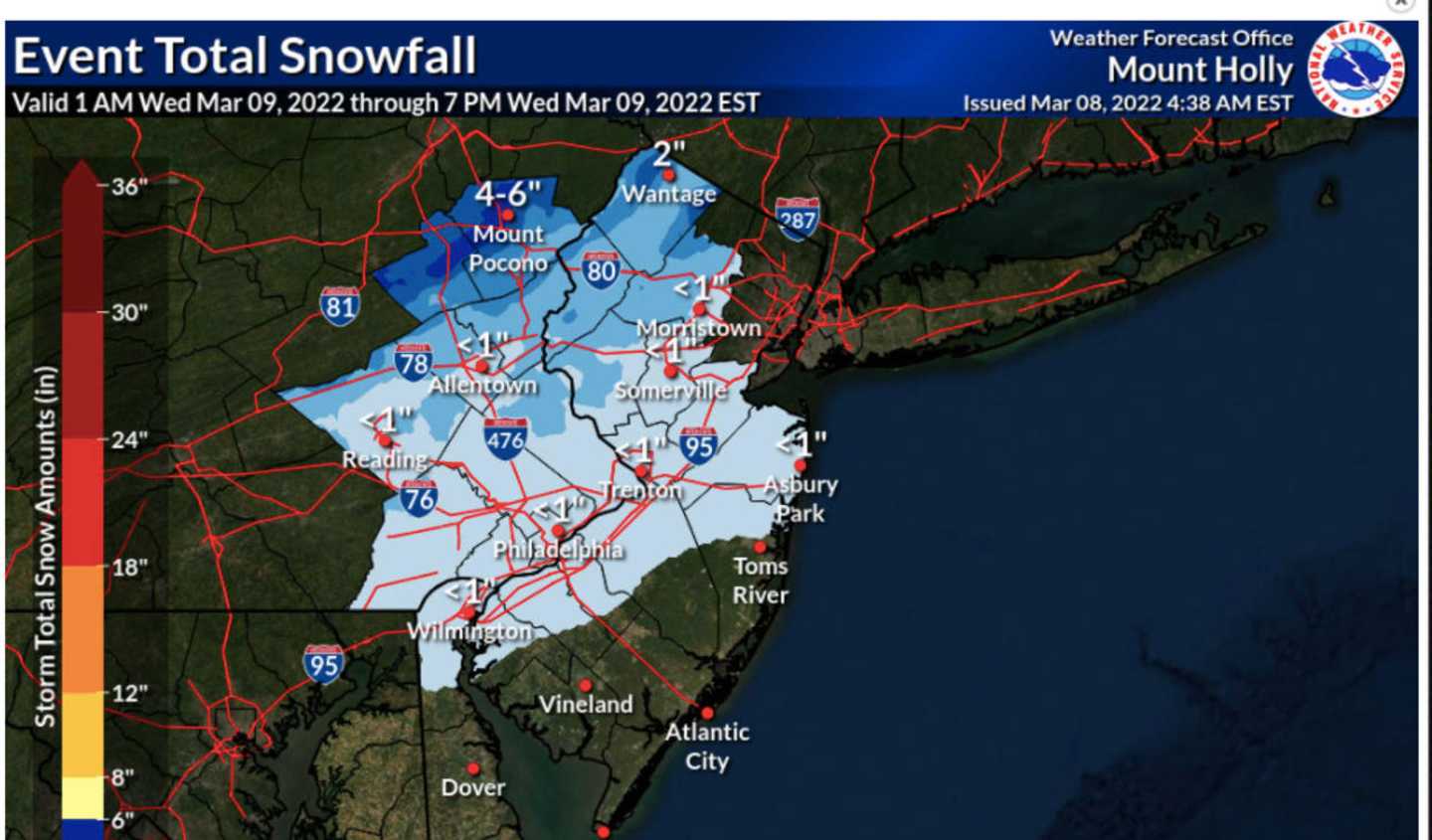
Snow and sleet are expected to be heaviest in the Poconos — which could get up to six inches, the National Weather Service predicts. Precipitation is expected to begin late Tuesday, March 8 and continue into the late morning Wednesday, March 9.
Parts of North Jersey and the Philadelphia area will see only an inch or two, but mostly on grassy surfaces, according to AccuWeather.com, calling the storm a "trouble-maker" and "late-bloomer."
A Winter Weather Advisory was in effect for Carbon and Monroe counties for 7 a.m. to 10 a.m. on Wednesday, the NWS said.
The rest of Pennsylvania and New Jersey will see rain instead of snow — but maybe a mix of both, forecasters say.
Temps Wednesday will be in the high 30s but will ramp up to the low 50s on Thursday, Friday and Saturday. Talk about a weather whiplash!
Click here to follow Daily Voice Adams and receive free news updates.