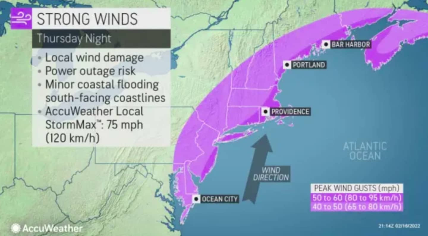
A powerful storm capable of producing severe weather across the country will bring howling, and potentially damaging, winds to the Northeast starting on Thursday, AccuWeather forecasters say.
Wednesday and Thursday have been warm and sunny but experts forecast a cold front moving in on Thursday night leading to high winds, rain, sleet and possibly snow, according to the National Weather Service.
Franklin, Perry, Dauphin, Schuylkill, Lebanon, Cumberland, Adams, York, and Lancaster will be under a wind advisory starting at 6 p.m. Thursday going through 9 a.m. Friday with the rest of central Pennsylvania having their wind advisories over around 7 a.m., according to NWS as part of the Hazardous Weather Outlook reported in central Pennsylvania.
The bulk of the high winds will blow in on Thursday evening at speeds up to 55 miles per hour, with sustained wind speeds of 15 to 25 mph, moving from the west across the state, the outlet reports.
Rain, sleet, and even some snow will Start in the wake of the cold front, coating the northwest with up to 2 inches of icy snow, and sending rain and freezing rain over to central Pennsylvania, NWS says.
The weekend will have freezing and below freezing temperatures again, leading to more high winds and frozen rivers, until mild temperatures return late Sunday, according to the outlet.
Click here to follow Daily Voice Adams and receive free news updates.