The first round of precipitation will come on Sunday, Dec. 15. Most locations will see rain either during the day or at night, according to the National Weather Service.
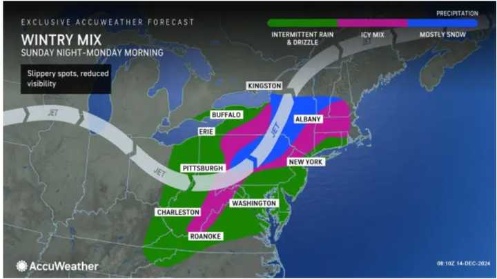
A mix of cold air and moisture might cause light wintry precipitation in these locations:
- North-central Maryland
- Southeastern Pennsylvania
- Northwestern New Jersey
- Hudson Valley, New York
- Western Connecticut and Massachusetts
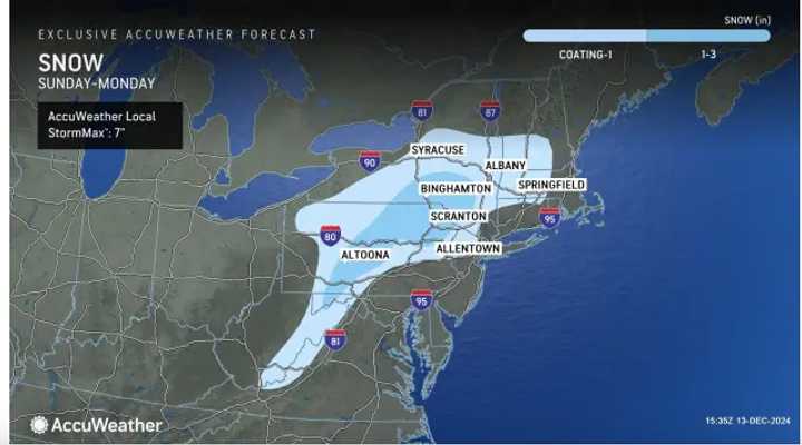
Areas shown in the darker shade of blue in the image above from AccuWeather could see up to 3 inches of snowfall and icy conditions from the system that will linger into Monday, Dec. 16.
Surrounding areas shown in the light shade of blue will see a coating to an inch.
There will be rain throughout the day on Monday and the high temperature will be in the mid-40s, and over 50 degrees farthest south.
Rain and showers will continue until around midday on Tuesday.
Check back to Daily Voice for updates.
Click here to follow Daily Voice Huntingdon Valley and receive free news updates.

