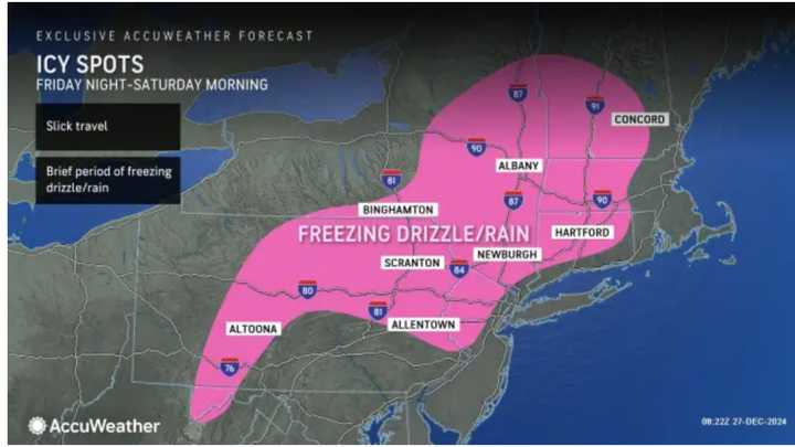
The National Weather Service forecasts this system from Friday night, Dec. 27, into early Saturday morning, Dec. 28. Areas expected to experience a wintry mix and ice are indicated in the image above from AccuWeather.
The time frame for the most potentially slickest travel is from midnight to just before daybreak on Saturday.
AccuWeather Senior Meteorologist Dave Dombek warns that a glaze of ice may form from western Maryland to north-central and northeastern Pennsylvania, northwestern New Jersey, upstate eastern New York, interior Connecticut, western and central Massachusetts, and the southern and central parts of Vermont and New Hampshire.
The National Weather Service cautions, “Dangerous travel conditions will be possible with icing on untreated and elevated roadways/surfaces.”
As milder air moves in, Saturday will see all rain with mostly cloudy skies and high temperatures in the 40s. Rain will continue on Sunday, with about an inch of precipitation expected over the weekend.
Check back to Daily Voice for updates.
Click here to follow Daily Voice Valley Stream and receive free news updates.

