Daily Voice Readers’ Choice
Accepting Nominations Now Through Sunday, October 11th
Nominate
Nominate Now
Southeast-Brewster
Your Local News for Southeast and Brewster, New York
Subscribe
Subscribe
Thursday, oct 1
73°
Breaking News
Your Community
On Your Side
National Interest
Trending
Events
Weather
Obituaries
Jobs
Advertise
Find Your Daily Voice
GO
Southeast-Brewster
Subscribe
Breaking News
Your Community
On Your Side
National Interest
Trending
Events
Weather
Obituaries
Legal
Tags
Jobs
Shop
Sponsored Content
Support Us
Home
About us
All sites
Advertise with us
Contact us
Terms of use
Privacy policy
Code of ethics
Site Map
© 2026 Cantata Media
73°
Thursday, oct 1
Weather
Tornado Confirmed In NY During Severe Storms: Here's When, Where
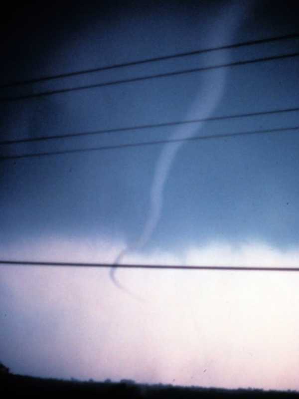
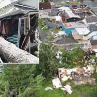
A tornado touched down in New York during a round of storms on Monday, June 9. The National Weather Service in Buffalo investigated storm-related damage from a rotating thunderstorm that affected the area around Great Valley in Cattaraugus County late in the afternoon. The tornado had peak winds of 110 miles per hour and was rated an EF-1 twister, the second-weakest of the six levels on the Enhanced Fujita damage scale. The twister had a path of 2.7 miles from 5:37 p.m. to 5:41 p.m. Several homes, garages, and structures lost walls and roofs. There was also significant …
Weather
How Much Snow Did You Get? A Look At Accumulation Totals From Putnam County
Here's a look at snowfall accumulation totals from throughout the region released by the National Weather Service for the storm that moved through Saturday night, Feb. 8 into Sunday, Feb. 9. Location Amount Time/Date Provider New York Westchester County 1 N Eastchester 4.8 inches 0810 AM 02/09 Public Mamaroneck 4.8 inches 0630 AM 02/09 Public 1 SSE Port Chester 4.6 inches 0715 AM 02/09 Public 1 ESE Hartsdale 4.5 inches 1000 AM 02/09 Trained Spotter 2 N Mamaroneck …
Weather
2 Inches Of Snow Could Fall This Weekend In Hudson Valley: Here's Your Forecast
A winter storm is poised to bring light to moderate snowfall to eastern New York, western Massachusetts, and parts of Connecticut from Friday morning, Dec. 20 through Saturday evening, Dec. 21, according to the National Weather Service. A Hazardous Weather Outlook has been issued for the region, warning of slippery travel conditions, particularly during the Friday evening commute. While snowfall amounts are expected to remain below advisory levels—less than 4 inches—hazardous road conditions are likely. Thursday will be partly sunny with a high near 39°F and northwest winds of 7 to 10 mph, …
Weather
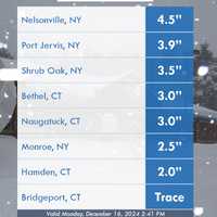
Putnam County Sees Snow Accumulations, Nelsonville Reports 4.5 Inches
The National Weather Service has released snow totals from this week's winter storm. Snowfall accumulation impacted areas across New Jersey, Pennsylvania, Connecticut, and New York, with Sussex County, NJ, and Putnam County, NY, seeing the highest totals from Sunday, Dec. 15 into Monday, Dec. 16. Below are detailed figures reported by state, county, and town, as per the National Weather Service: New Jersey Mercer County: Trenton Mercer Airport: Trace (11:59 PM, 12/15) Morris County: Butler (1 S): 3.0 inches (5:15 AM, 12/16) Sussex County: Wantage Twp: 4.1 inches (5:00 AM, 12/16) Wan…
Weather
How Much Snow Did You Get? Here Are Totals From Putnam County
Here's a look at snowfall totals reported by the National Weathe Service from throughout the region from the storm system that swept through Thursday, Nov. 21 into Friday, Nov. 22. New York New York City Central Park 1.86 in 0940 AM 11/22 AWS Nassau County Oyster Bay 2.25 in 0930 AM 11/22 CWOP Locust Valley 0.3 E 2.21 in 0910 AM 11/22 COCORAHS Albertson 0.2 SSE 2.09 in 0730 AM 11/22 COCORAHS Syosset 2.08 in 0800 AM 11/22 COOP Herricks 1.92 in 0830 AM 11/22 COCORAHS Port Washington 0.8 N 1.84 in 0719 AM 11/22 COCORAHS Massapequa 1.1 SE 1.80 in 0700 AM 11/22 COCORAHS Malverne 0.5 SE…
Weather
New Tornado Confirmed Amid Record-Setting Year In NY: Here's When, Where
A new tornado just touched down in New York in what has been a historic year for twisters in the state. There have now been 29 tornadoes in New York this year, breaking the record of 25 in 1992. A National Weather Service Storm Survey Team examined several reports of damage in Allegany County, in the towns of Wirt and Friendship, located near Buffalo, after the incident happened in the middle of the evening on Friday, Sept. 6. "The damage found was consistent with a tornado, with several areas of concentrated and extensive tree damage," the weather service said. The tornado had peak wind…
Weather
'We Will Rebuild': Powerful Storm, Flooding Leave Trail Of Destruction Across Parts Of NY
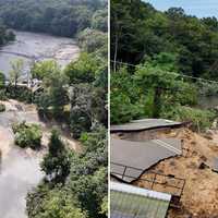
At least six homes were heavily damaged and roads were washed out following a powerful storm system that brought drenching rain and widespread flooding to parts of New York and Connecticut. On Long Island, Suffolk County Executive Ed Romaine issued a state of emergency on Monday, Aug. 19, after surveying flood damage caused when up to nine inches of rain fell in parts of the county overnight. “Our longtime Mill Pond is gone. Six houses along here were damaged, their cesspools and personal belongings are now floating down this creek into the sound,” Romaine told reporters. Earlier Report:…
Weather
Debby: Homes, Businesses In Northern Westchester Could Be Without Power For Days
Strong winds from Tropical Depression Debby continued to wreak havoc on New York and the Hudson Valley into Friday evening, Aug. 9. In the Northern Westchester County village of Ossining, police said downed trees had knocked out power to homes and businesses south of Charter Circle near Highland Avenue. The outage area included the Arcadian Shopping Center, located near Highland and Rockledge avenues, home to a Stop & Shop and nearly two dozen other businesses. Earlier Report: Strong Winds From Debby Knock Out Power In Westchester Con Edison said the area would be without power…
Weather
2 Tornadoes Confirmed In NY This Week: Here's When, Where
A pair of new tornadoes have been confirmed in New York this week. Both occurred upstate on Wednesday, July 24, and they come after 10 twisters hit central and northern New York last week. In Oswego County, the first tornado on Wednesday touched down just before 3:30 p.m. in the town of Orwell, about 40 miles north of Syracuse. It left a short, coherent path of broken tree limbs extended down an east-west path and had peak winds of 85 miles per hour, ranking it as an EF-0 tornado, the weakest of six levels on the Enhanced Fujita Scale, according to the National Weather Service. The o…
Weather
Support Swells After Series Of Tornadoes Devastate NY Homes, Businesses: 'Anything Helps'
Donations are flooding in for the victims devastated by a series of tornadoes that touched down in New York during a round of severe storms. At least six twisters touched down in Central New York between 3 p.m. and 5:30 p.m. Tuesday, July 16, the National Weather Service confirmed. They were identified at: Canastota, Madison County - EF-1, from 3 p.m. to 3:07 p.m. Peak winds - 100 mph. Rome, Oneida County - EF-2, from 3:25 p.m. to 3:35 p.m. Peak winds - 135 mph. Oxbow Lake, Hamilton County - EF- 1, from 4:29 p.m. to 4:30 p.m., Peak winds - 100 mph. Wells, Hamilton County - EF-1, from 4:30…
Weather
Tornado May Have Touched Down In Hudson Valley During Round Of Severe Storms
An investigation is underway to determine if a tornado touched down in the Hudson Valley during a round of severe storms on Thursday, May 23. The probe is focusing on the Orange County village of Greenwood Lake. Starting at around 7:20 a.m., a total of 34 calls were received reporting various issues related to the storm such as downed trees and power lines, alarm activations, vehicle rescues, gas leaks, structural damage reports and other fire type call, according to Orange County Emergency Services. The department said it is working with the National Weather Service to identify …