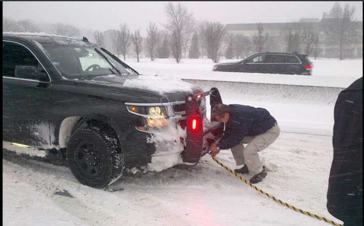
With whiteout conditions reported in much of the area, a travel ban has been issued by Gov. Andrew Cuomo for downstate New York that includes all local and state roads in New York City and Long Island.
The full travel ban in New York City and Long Island took effect at 2:30 p.m. Saturday and expires at 7 a.m. Sunday.
Cuomo had earlier declared a State of Emergency that includes New York City, Long Island, Westchester, Putnam, Rockland and Orange counties.
An earlier report that the ban included all of downstate New York, including Westchester, Putnam and Rockland was incorrect.
Metro-North stopped service at 4 p.m. For more on that, click here. Cuomo said Metro-North's status for resuming service will be assessed at 6 a.m. Sunday.
Cuomo also announced the closure of all state parks and Department of Environmental Conservation properties and facilities located within the impacted areas, including Westchester, Rockland and Putnam.
On closed roads, only authorized emergency vehicles will be permitted. A violation of the travel ban is punishable as misdemeanor that includes fines of up to $300. Cuomo signed an Executive Order authorizing the state to institute the travel ban on local and state roads.
Cuomo reported plows cannot keep up with snowfall at its current rate in parts of downstate New York.
“Safety is our No. 1 priority – and right now, it is not safe for the general public to travel,” said Cuomo. “Closing the roads and exterior railroads and subways is the right thing to do in this situation, because it helps emergency personnel do their jobs and respond to the storm as aggressively as possible.
"We are doing everything necessary to keep people safe, and I encourage all New Yorkers to wait out the storm indoors.”
All of Westchester, Putnam, Rockland and Dutchess are now under a Winter Storm Warning. Dutchess County had been under a Winter Storm Advisory before it was upgraded to warning status late Saturday morning.
The warning, originally scheduled to take effect at 6 a.m. Saturday, has been pushed up to 4 a.m. It was originally scheduled to expire at 1 p.m. Sunday. But is now is scheduled to end at 7 a.m. Sunday.
A combination of steady snow and strong winds is making for treacherous conditions as a monster storm that has been burying Mid-Atlantic states with snow and powerful sustained winds arrived in the area earlier than expected.
In addition, the storm is tracking farther north than originally anticipated, with projected snowfall totals doubling for some parts of the area.
Southern-most Westchester and New York City are now expected to see as much 18-24 inches of snow with anywhere from 12-18 inches of snow forecast for most Westchester and Rockland. Northern Westchester, Putnam. and Northern Rockland are now projected to get 8-12 inches.
Totals for Dutchess County, which had originally been projected as between 1 to 3 inches, could be as high as 5 to 6 inches in some parts of the county.
A Blizzard Warning which had been issued for New York City now includes Southern Westchester and is in effect until 4 a.m. Sunday.
Strong gusts of between 50 and 60 miles per hour are expected along coastal areas with power outages possible.
Nearly all flights have been canceled.
Snow, which started around dawn in parts of the area, should wind down in the late evening hours Saturday in most of the area with some snow showers overnight.
Gusty winds are expected to continue through Sunday, which will be a mostly sunny day with highs in the mid 30s.
Check back to Daily Voice for updates.
Click here to follow Daily Voice Poughkeepsie and receive free news updates.


