SHARE

Final Long Island Snowfall Projections Released For Major Winter Storm

Final projected snowfall totals have been released for a major winter storm that will be followed by a days-long stretch of bitterly cold temperatures.

Areas shown in yellow in the first image above are projected to see the most snowfall, with 6 to 8 inches of accumulation predicted, the National Weather Service says.

Areas shown in yellow in the first image above are projected to see the most snowfall, with 6 to 8 inches of accumulation predicted, the National Weather Service says.

Photo Credit: National Weather Service
A Winter Storm Warning is in effect in areas shown in pink from 1 p.m. Sunday, Jan. 19, until 4 a.m. Monday, Jan. 20. A Winter Weather Advisory is in effect in the locations shown in purple.

A Winter Storm Warning is in effect in areas shown in pink from 1 p.m. Sunday, Jan. 19, until 4 a.m. Monday, Jan. 20. A Winter Weather Advisory is in effect in the locations shown in purple.

Photo Credit: National Weather Service

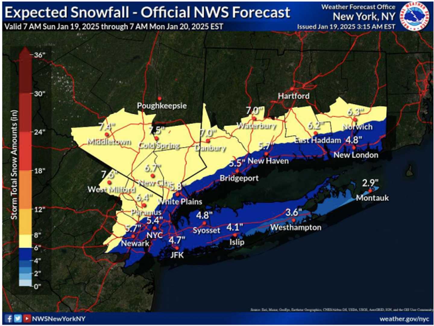
The storm will arrive Sunday afternoon, Jan. 19 and wrap up before daybreak on Martin Luther King Jr. Day on Monday, Jan. 20.

Areas shown in yellow in the first image above are projected to see the most snowfall, with 6 to 8 inches of accumulation predicted, the National Weather Service says.

In those locations, snow may fall at rates of between a half-inch to an inch per hour at times, with the heaviest snowfall expected between 6 p.m. Sunday and midnight Monday.

Travel will become difficult with snow-covered roads and poor visibility.

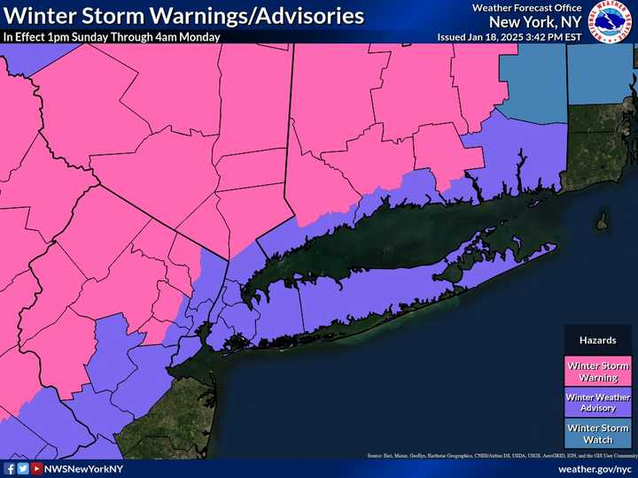
A Winter Storm Warning is in effect in the locations shown in pink in the second image above from early Sunday afternoon until daybreak Sunday. A Winter Weather Advisory is in effect in surrounding areas.

Check back to Daily Voice for updates.

to follow Daily Voice Plainview-Old Bethpage and receive free news updates.

SCROLL TO NEXT ARTICLE