The timing for the system is overnight Friday into early Saturday afternoon, Feb. 17.
The highest likelihood for snow is between about 2 a.m. and 8 a.m. Saturday.
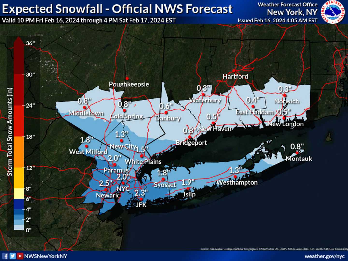
In a brand-new forecast map released by the National Weather Service on Friday morning and shown above, areas in the darkest shade of blue are expected to see the most snowfall, with more than 2 inches expected in parts of Nassau County, Queens, and Northern New Jersey.
Parts of Westchester, Fairfield, Rockland, and Orange counties (shown in Columbia blue) and the rest of Long Island could get around 1.5 inches of accumulation.
Elsewhere, about an inch or less is forecast (areas shaded in sky blue).
After the system pushes through, there will be gradual clearing on Saturday afternoon as the high temperature reaches the mid-30s.
Check back to Daily Voice for updates.
Click here to follow Daily Voice New City and receive free news updates.