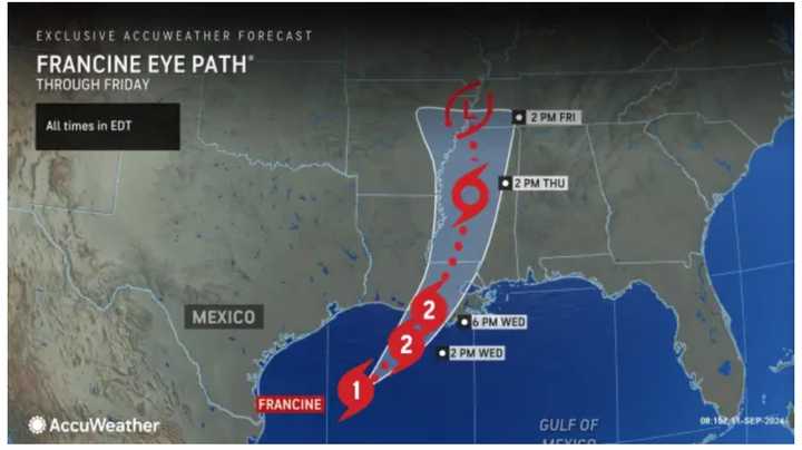
The Category 1 storm is expected to make landfall on Wednesday night, Sept. 11, in southeast Louisiana.
Rainfall amounts of 6 to 12 inches, storm surge of 5 to 10 feet, and wind gusts of 75 miles per hour and higher are expected. Tornadoes are also possible.
Francine became a hurricane at 8 p.m. Tuesday, Sept. 10.
It's expected to gain more strength and become a Category 2 hurricane as it enters warm, open waters prior to landfall, according to AccuWeather.com. (See the first image above.)
Francine will likely have some negative effect on petroleum operations in the Gulf Coast, which could be reflected as higher prices at the pump for a time, AccuWeather notes.
For a look at the projected track and timing for the storm from the National Hurricane Center, click on the second image above.
Check back to Daily Voice for updates.
Click here to follow Daily Voice Mineola and receive free news updates.

