A widespread 2 to 4 inches of snowfall is predicted for a new winter storm taking aim at the region. Here's what to know now:
Storm Timing
Sunday night, Jan. 19 into Monday morning, Jan. 20
Storm Range
A coating in some locations to as much as a few inches will extend from the southern Appalachians to the mid-Atlantic coast from Sunday afternoon into central and southeastern New England Sunday evening to early Monday.
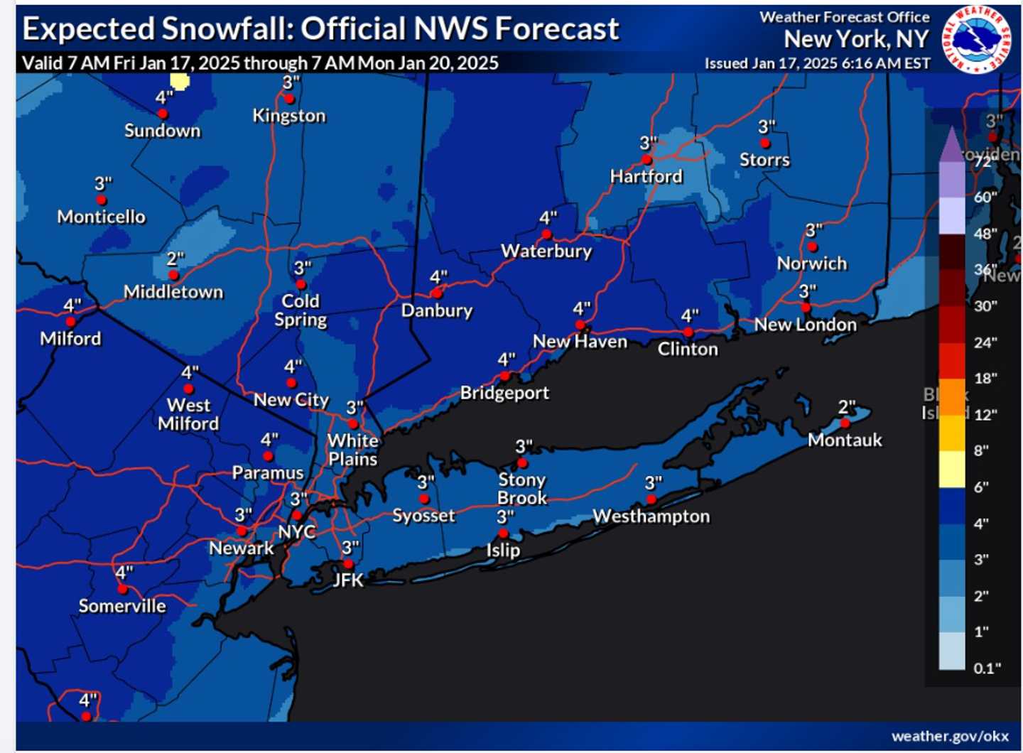
Snowfall Projections
See the image above
- Darkest shade of blue - 4 inches,
- Next shade of blue - 3 inches,
- Light shade of blue - 2 inches
- There is the potential for up to a half-foot in some locations, especially with higher elevations.
Forecast For Days Prior To Storm
On Friday, Jan. 17, skies will be clear at the end of the workweek, and temperatures will rise slightly, with highs generally reaching the upper 30s.
Overnight, it will become overcast, with mostly cloudy conditions expected throughout the day. This sets the stage for a system that may bring snow to parts of the Northeast and Midwest Saturday night, Jan. 18. (Refer to the second image above for more details.)
Sunday will start partly sunny before clouds increase as the storm system moves from the south to the north.
Check back to Daily Voice for updates.
Click here to follow Daily Voice Mastic-Shirley and receive free news updates.