Daily Voice Readers’ Choice
Accepting Nominations Now Through Sunday, October 11th
Nominate
Nominate Now
Massapequa
Your Local News for Massapequa, New York
Subscribe
Subscribe
Saturday, sep 26
56°
Breaking News
Your Community
On Your Side
National Interest
Trending
Events
Weather
Obituaries
Jobs
Advertise
Find Your Daily Voice
GO
Massapequa
Subscribe
Breaking News
Your Community
On Your Side
National Interest
Trending
Events
Weather
Obituaries
Legal
Tags
Jobs
Shop
Sponsored Content
Support Us
Home
About us
All sites
Advertise with us
Contact us
Terms of use
Privacy policy
Code of ethics
Site Map
© 2026 Cantata Media
56°
Saturday, sep 26
Weather
2 Tornadoes Confirmed In NY This Week: Here's When, Where
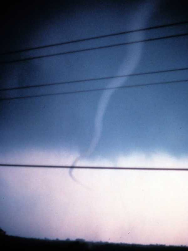
A pair of new tornadoes have been confirmed in New York this week. Both occurred upstate on Wednesday, July 24, and they come after 10 twisters hit central and northern New York last week. In Oswego County, the first tornado on Wednesday touched down just before 3:30 p.m. in the town of Orwell, about 40 miles north of Syracuse. It left a short, coherent path of broken tree limbs extended down an east-west path and had peak winds of 85 miles per hour, ranking it as an EF-0 tornado, the weakest of six levels on the Enhanced Fujita Scale, according to the National Weather Service. The o…
Weather
Support Swells After Series Of Tornadoes Devastate NY Homes, Businesses: 'Anything Helps'
Donations are flooding in for the victims devastated by a series of tornadoes that touched down in New York during a round of severe storms. At least six twisters touched down in Central New York between 3 p.m. and 5:30 p.m. Tuesday, July 16, the National Weather Service confirmed. They were identified at: Canastota, Madison County - EF-1, from 3 p.m. to 3:07 p.m. Peak winds - 100 mph. Rome, Oneida County - EF-2, from 3:25 p.m. to 3:35 p.m. Peak winds - 135 mph. Oxbow Lake, Hamilton County - EF- 1, from 4:29 p.m. to 4:30 p.m., Peak winds - 100 mph. Wells, Hamilton County - EF-1, from 4:30…
Weather
Tornado May Have Touched Down In Hudson Valley During Round Of Severe Storms
An investigation is underway to determine if a tornado touched down in the Hudson Valley during a round of severe storms on Thursday, May 23. The probe is focusing on the Orange County village of Greenwood Lake. Starting at around 7:20 a.m., a total of 34 calls were received reporting various issues related to the storm such as downed trees and power lines, alarm activations, vehicle rescues, gas leaks, structural damage reports and other fire type call, according to Orange County Emergency Services. The department said it is working with the National Weather Service to identify …
Weather
Long-Range Summer Outlook For Severe Weather, Temps Released: Here's What To Expect
Spring has sprung, but the thermometer must not have gotten the memo, as plenty of raw days have made it feel more like fall. But when it comes to the summer, in the words of Ron Burgundy, expect things to escalate really quickly. According to AccuWeather's brand-new outlook for the summer of 2024, it's going to be a hot season for most areas of the United States, including the Northeast. The anticipated heat will contribute to an uptick in severe weather, AccuWeather says. "Severe weather events can be frequent in June and part of July," said AccuWeather Senior Meteorologist and Head of …
Weather
Smoky Skies: Wildfires Burning In Canada Could Affect Air Quality In Northeast Again
Smoke from wildfires burning across Canada could once again significantly affect air quality in the Northeast this year, according to a brand-new report. AccuWeather long-range forecasters say the 2024 wildfire season is expected to start in June and peak in September. Wildfires in Canada broke records last year, with 45.7 million acres of land burned. AccuWeather's lead long-range forecaster, Paul Pastelok, predicts a near-to-above-historical average number of fires in Canada this year, but he expects fewer fires to burn than last year. Smoke from Canadian wildfires last June cause…
Weather
Separate Rounds Of Showers Will Follow Late Winter Warmup: 5-Day Forecast
Separate rounds of showers will follow a springlike stretch marked by mild temperatures and clear skies. It will be sunny with temperatures above average on Wednesday, March 13, and Thursday, March 14 with high temperatures in the mid-60s on Wednesday and upper 60s on Thursday with calm winds. The first round of showers will move in overnight Thursday into Friday, March 15. Showers will continue through early Friday afternoon on a mostly cloudy day with temps in the 60s. There will be another round of showers early Friday evening. A total of about a quarter of an inch of precipitation is…
Weather
Tornado Touched Down In NY For Only Second Time Ever In February: Here's Where
A tornado touched down in New York during a potent storm packed with damaging gusty winds accompanying a cold front last week, the National Weather Service has announced. A damage survey determined the timing to be around 5:20 p.m. Wednesday, Feb. 28 in Broome County about 10 miles north of Binghamton in the hamlet of Castle Creek. It had an estimated maximum wind speed of 100 miles per hour. The tornado tracked 0.61 miles, with a width of 150 yards. The twister was rated an EF-1 on the Enhanced Fujita scale, the second-weakest of the six levels. Related story - 72 MPH Wind…
Weather
72 MPH Wind Gust Reported During Storm: Here's Rundown From Region
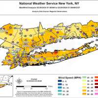
Did you hear it howling overnight? You're not alone. Widespread 40 to 50-mile-per-hour wind gusts were reported across the region as a powerful storm accompanying a frontal system swept through the Northeast. The highest reported gust -- at 72 miles per hour -- happened on Long Island just before 12:30 a.m. Thursday, Feb. 29 on top of a building in Stony Brook at 159 feet, according to the National Weather Service. Here are more wind-gust reports from locations in New York and Connecticut. Location Speed Time/Date Provider New York Nassau County …
Weather
Blockbuster Hurricane Season Could Be Coming: 'Serious, Growing Concerns,' Says Forecaster
Click here for a new, updated story: Hurricane Season In 2024 Could Be One Of Most Active Ever, NOAA Says: Here's Why The return of La Niña and historically warm water across the Atlantic Ocean have some forecasters sounding the alarm about what could be a super-charged 2024 hurricane season. Those two factors will set the groundwork for a potentially blockbuster season, and there are already “serious and growing concerns," AccuWeather Chief Meteorologist Jonathan Porter said. The season runs from Saturday, June 1 through Saturday, Nov. 30. La Niña typically leads to mor…
Weather
Snowfall Map: Here's How Accumulation Amounts In These NY Spots Compare To Normal Winters
Most locations in the region have seen more snowfall than last winter, but only one location in the Northeast has exceeded the seasonal average, according to new data. "Now reaching the back stretch of the winter season, current snowfall totals across not only our area, but a large portion of the East remains below the seasonal averages," according the US National Weather Service Eastern Region Headquarters. In the first image above, areas in red have seen the most snowfall through Sunday, Feb. 18 while locations in white and sky blue have seen the least. A comparison of snowfall tota…
Weather
How Much Snow Did You Get? New Winter Storm Produces Higher-Than-Expected Totals In These Areas
A quick-moving winter storm that is now moving east produced higher-than-expected snowfall totals in some parts of the region, especially in and around New York City and on Long Island. Totals are from the National Weather Service and submissions from Daily Voice readers: Location Amount Time/Date Provider New York New York City New York County (Manhattan) Central Park 2.0 inches 0700 AM 02/17 Official NWS Obs SE Greenwich Village 3.2 inches 0920 AM 02/17 NWS Employee Kings County (Brooklyn) Coney Island 9.9 inches 0655 AM 02/17 Trained Spotter Coney Is…
Weather
New Update: How Much Snow Did You Get? Reports From Westchester, Region For Winter Storm
Here are snowfall reports from the region for the winter storm that is sweeping through the Northeast on Tuesday, Feb. 13. Totals are from the National Weather Service and submissions from Daily Voice readers: Location Amount Time/Date Provider New York Westchester County Peekskill 10.3 inches 1000 AM 02/13 Public Croton-on-Hudso 10.5 inches 12:45 PM 02/13 Daily Voice reader submission North Salem/Peach Lake 10.0 inches 0430 PM 02/13 Daily Voice reader submission Croton-on-Hudson …
Next Page
Archive