
Timing
The system will arrive in the mid-Atlantic around midday Wednesday, March 5, with rain and thunderstorms, some of which will be severe. It will then move north through Pennsylvania and New Jersey, hitting the New York metropolitan area in time to disrupt the evening commute before affecting New England.
Wind Conditions
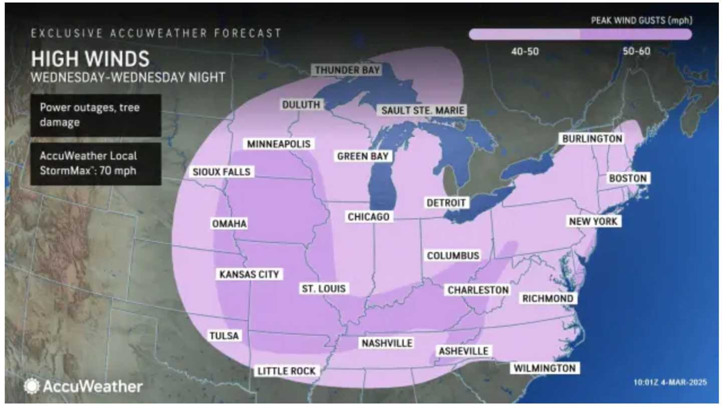
Wind gusts are expected to reach between 40 to 50 mph across the Northeast, with gusts potentially exceeding 60 mph along the Jersey Shore and in eastern Maryland and Virginia that could lead to power outages. (See the first image above from AccuWeather.)
Precipitation Forecast
From the arrival of the storm Wednesday afternoon through Wednesday night, areas may receive up to 2 inches of rain, according to the National Weather Service.
During this period, scattered thunderstorms, some of which may be strong, are anticipated.
Thunderstorms are most likely in regions shaded in the darkest green in second image above.
Travel Implications
The strongest wind gusts will occur on Wednesday night.
“The winds associated with the storm can become strong enough to cause widespread travel disruptions,” stated AccuWeather Meteorologist Elizabeth Danco. “They can also lead to downed trees and power lines across the eastern two-thirds of the nation through Wednesday night.”
After the Storm
Following the system’s passage, conditions will improve, with partly sunny skies expected on Thursday, March 6, and high temperatures rising into the 50s.
Check back to Daily Voice for updates.
Click here to follow Daily Voice Islip and receive free news updates.