
The system is now expected to hit the Northeast overnight Thursday, Jan. 30 into Friday, Jan. 31, according to the National Weather Service.
"This storm will bring a large area of precipitation to the Northeast Thursday night through Friday, falling mainly as rain in most places," AccuWeather Meteorologist Nick Arman said. "However, as precipitation moves in during the early morning hours of Friday, areas in Pennsylvania and New York with subfreezing temperatures will see potential ice accumulations from freezing rain, mainly during the predawn hours."
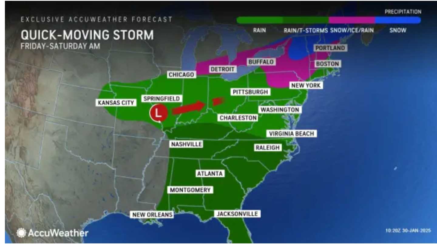
For precipitation types by location, click on the first image above from AccuWeather.
As much as a half-foot of snowfall is expected in some areas farthest north in upstate New York and northern New England. A total of 1 to 3 inches of accumulation is predicted in the areas shown in the lightest shade of blue in the second image above.
"Even if the air temperature remains just above freezing, ground temperatures can be a few degrees lower, particularly in areas where snow has persisted, leading to precipitation freezing on some surfaces," AccuWeather notes. "Roads that remain heavily salted should face minimal issues with slick conditions, but bridges, overpasses and typically shaded areas will be the most vulnerable."
The outlook for Saturday, Feb. 1 calls for sunny skies and seasonable temperatures.
Check back to Daily Voice for updates.
Click here to follow Daily Voice East Hampton and receive free news updates.