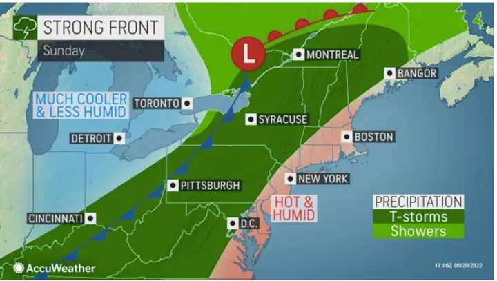
The high temperature on Sunday, May 22 will top out in the low 90s, according to the National Weather Service.
Clouds will increase after noontime and there will be a chance of showers and thunderstorms starting late in the afternoon and continuing into the evening and overnight hours as a strong front pushes through the region.
For areas most likely to see severe storms, see the two images above.
"The main threat in the Northeast appears to be strong wind gusts and downpours capable of localized flooding," said AccuWeather Meteorologist Adam Sadvary. "The threat for hail and tornadoes is less likely, but one or two tornadoes can't be ruled out, especially in northern New England,"
Monday, May 23 will see a return to more seasonable temperatures with a high temperature in the low 70s and partly sunny skies.
Tuesday, May 24 will be partly sunny with a high temperature at or near 70 degrees.
Wednesday, May 25 will be mostly cloudy with a high temperature around 70 degrees.
Check back to Daily Voice for updates.
Click here to follow Daily Voice Clifton Park and receive free news updates.

